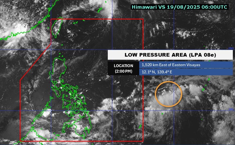
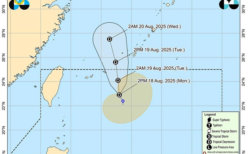
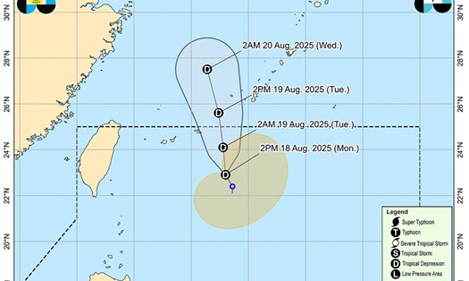
According to the Philippine Atmospheric, Geophysical and Astronomical Services Administration (PAGASA), a tropical depression is active near the East Sea, outside the Philippine Area of Responsibility. The tropical depression is named Huaning.
As of 11:00 a.m. on August 19, the center of the tropical depression was at about 26.3 degrees North latitude - 128.0 degrees East longitude, 880 km northeast of the northernmost tip of Luzon.
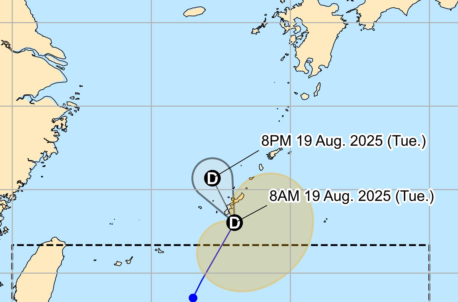
The tropical depression is moving north-northeast at a speed of 45 km/h. The strongest wind near the center of the storm will remain at 55 km/h, gusting up to 70 km/h.
The tropical depression is unlikely to develop into a tropical storm in the next 24 hours.
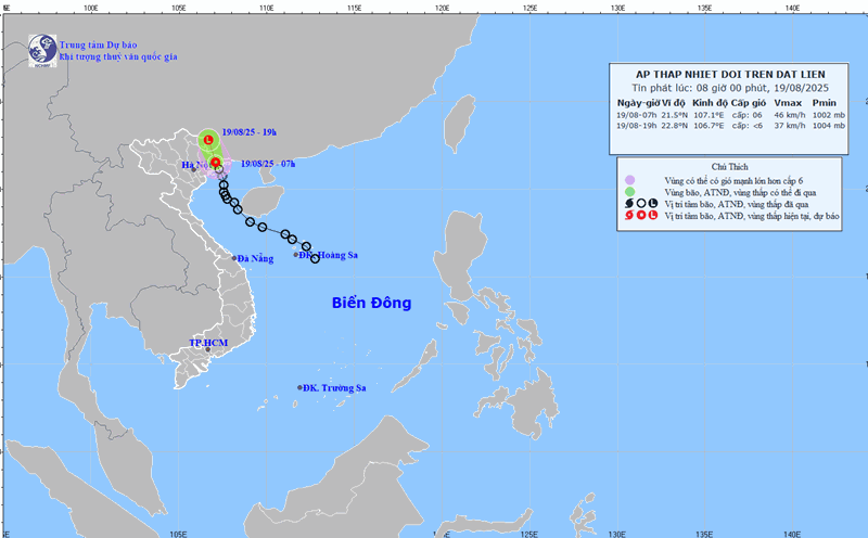
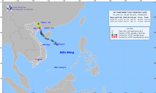
Meanwhile, the tropical depression on the mainland of Northern Vietnam has weakened into a low pressure area. According to the National Center for Hydro-Meteorological Forecasting, at 10:00 a.m. on August 19, the center of the low pressure area was at about 21.5 - 22.5 degrees North latitude - 106.4 - 107.4 degrees East longitude. The strongest wind in the center of the low pressure area drops below level 6 (under 39 km/h).
The low pressure area is moving mainly in the North-Northwest direction, traveling about 15 km/h, and its intensity continues to weaken.
Due to the influence of the low pressure, the northern area of the Gulf of Tonkin (including the special areas of Bach Long Vi, Cat Hai, Co To and Van Don) will still have thunderstorms during the day and night of August 19. During thunderstorms, there is a possibility of tornadoes and strong gusts of wind of level 7-8.
In the next 3-6 hours, the areas of Son La, Lang Son, Quang Ninh, Thanh Hoa, Cao Bang provinces will continue to have rain with common accumulated rainfall as follows: Son La, Cao Bang, Quang Ninh and Thanh Hoa from 20-50mm, some places over 70mm; Lang Son from 10-30mm, some places over 50mm.
In the next 6 hours, there is a risk of flash floods on small rivers and streams, landslides on steep slopes in many communes/wards.
People and tourists in these areas should pay attention to weather forecasts. Follow local instructions to avoid dangerous storms and flash floods.

