According to the latest weather forecast from the Philippine Atmospheric, Geophysical and Astronomical Services Administration (PAGASA), Typhoon Penha is approaching the mainland Philippines.
As of 8 pm today (local time), the storm's center is located at about 8.0 degrees North latitude - 129.4 degrees East longitude, about 340 km east of Hinatuan, Surigao del Sur.
The strongest wind in the area near the center of the tropical depression reached 65 km/h, gusting up to 80 km/h. The storm is moving in a westerly direction at a speed of 25 km/h.
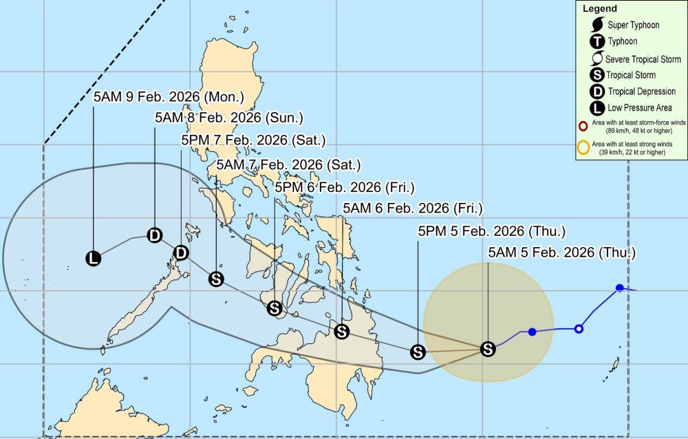
PAGASA forecasts that the typhoon will move from its current location in the Southeast of the Philippines, turn west through Mindanao, then move northwest towards Visayas. Typhoon Penha is expected to pass through the mainland Philippines and enter the East Sea between February 8-9.
However, during its time moving through the mainland, Typhoon Penha is likely to weaken into a tropical depression before entering the East Sea.
Tropical storm warning level 2, with winds from 62-88 km/h (possibly causing mild to moderate damage to structures and vegetation) is issued by the Philippine government in the following areas: Some areas of Eastern Samar, Samar, Biliran, Leyte, Southern Leyte, Bohol, Cebu, Siquijor, Negros province, Guimaras, Iloilo, Capiz, Aklan and some areas in Mindanao,
Warnings include heavy rain, tsunamis up to 2 meters high in coastal areas such as the Dinagat Islands and Surigao province, and strong gusts from the Northeast monsoon affecting most of the country.
People are advised to prepare for floods, protect property and avoid traveling by sea, as small boats are at risk of encountering incidents due to rough seas.
Tourists planning to visit the Philippines during this time should pay attention to weather forecasts. Check your flight schedule and follow local instructions to avoid dangerous storms.


