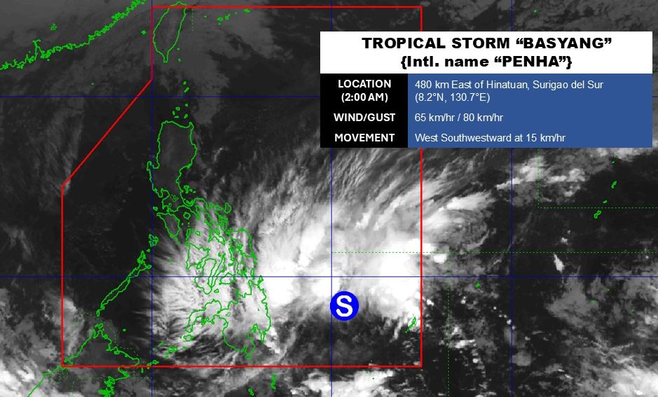
According to the latest weather forecast from the Philippine Atmospheric, Geophysical and Astronomical Services Administration (PAGASA), tropical depression Basyang near the East Sea has officially strengthened into a storm (international name Penha).
As of 2:00 AM today (local time), the storm's center is located at about 8.2 degrees North latitude - 130.7 degrees East longitude, about 480 km east of Hinatuan, Surigao del Sur.
The strongest wind in the area near the center of the tropical depression reached 65 km/h, gusting up to 80 km/h. The storm is moving in a southwest direction at a speed of 15 km/h.
Due to the impact of the storm, some areas including the Dinagat Islands, Surigao del Norte, Surigao del Sur and Davao Oriental received rainfall from 50-100 mm.
12 areas on the mainland of the Philippines are warned to level 1, expected to have strong winds from 39 to 61 km/h and intermittent rain for at least 36 hours to come, including: Visayas, southern part of Eastern Samar (Guiuan, Salcedo, Mercedes, Giporlos, Balangiga, Lawaan, Quinapondan, General Macarthur, Hernani, Llorente, Maydolong, Balangkayan, Borongan City).
South of Samar (Marabut, Basey), South Leyte, central part and south of Leyte (Matalom, Bato, Hilongos, Hindang, Inopacan, Mahaplag, Abuyog, Macarthur, Javier, City of Baybay, Tolosa, Palo, Tacloban City, Santa Fe, Pastrana, Dagami, Albuera, Tabontabon, Tanauan, Dulag, Julita, La Paz, Mayorga, Burauen).
In the East Sea, according to the National Center for Hydro-Meteorological Forecasting, the northeastern sea area of the Northern East Sea has Northeast wind level 6, gusts level 7-8; waves 3.0-5.0m high; rough seas.
Sea area from Khanh Hoa to Ho Chi Minh City and sea area west of the South East Sea (including sea area west of Truong Sa special zone): Northeast wind level 6, gusts level 7-8; waves 2.0-4.0m high; rough seas.
People and tourists planning to visit these sea areas or travel to the Philippines during this time should pay attention to weather forecasts. Check flight schedules to be proactive in travel plans. Follow local instructions to avoid dangerous storms.


