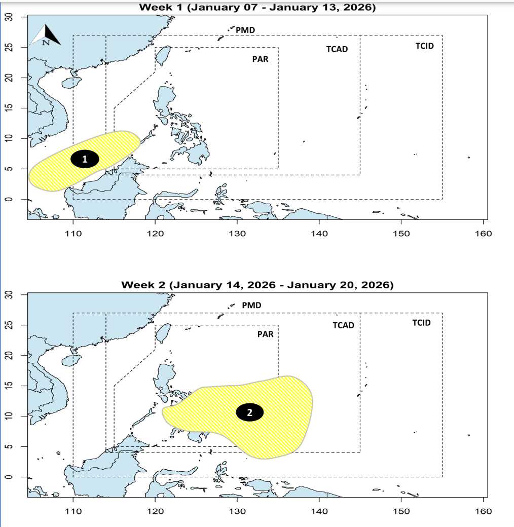
According to storm and low pressure warnings from the Philippine Atmospheric, Geophysical and Astronomical Services Administration (PAGASA), 2 low pressures are likely to appear inside and near the East Sea in the first 2 weeks of January.
Accordingly, in the first week (from January 7-13), a low pressure area is likely to appear in the southern area of the East Sea, near the southern area of Palawan. This low pressure area is unlikely to develop strongly into a tropical depression.
In the next week (from January 14-20), low pressure No. 1 is likely to weaken and dissipate. Meanwhile, the 2nd low pressure appears inside the Philippine Responsibility Area (PAR). The low pressure gradually moves to the northern area of Mindanao and Visayas, possibly crossing the Philippine mainland and entering the East Sea.
PAGASA forecasts that this low pressure is also unlikely to develop strongly into a tropical depression.
According to the National Center for Hydro-Meteorological Forecasting, there is little chance of storms/tropical depressions appearing in the East Sea in January.
The meteorological agency also forecasts that from January to March 2026, storms are less likely to appear in the East Sea. From April to June 2026, storms or tropical depressions in the East Sea area are equivalent to the multi-year average, but the possibility of landfall in our country is not high.
According to multi-year average data in the period from April to June, there were about 1.8 storms/tropical depressions in the East Sea, making landfall of 0.3 storms.
However, due to the influence of monsoons and cold air, large waves, strong winds, and strong sea waves often appear in the East Sea.
Therefore, people and tourists planning to go to sea should pay attention to weather forecasts. Avoid going out when the sea is rough and follow local instructions to avoid big waves causing danger.


