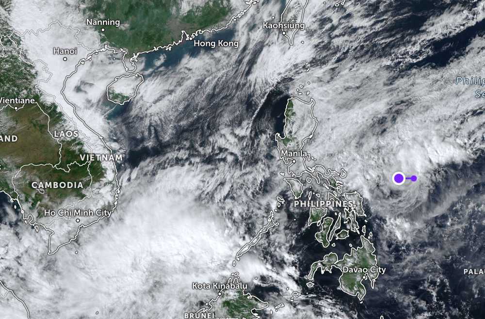
According to the latest low pressure news from the Joint Typhoon Warning Center (JTWC), on the morning of January 6, a new low pressure appeared near the East Sea.
The center of the low pressure is located in the east of Samar Island (Philippines). The strongest wind near the center of the tropical depression reaches 30 km/h.
The low pressure area is forecast to have little chance of developing strongly into a tropical depression or storm in the next 24 hours.
Meanwhile, the low pressure area formed in the southern South China Sea has disintegrated.
According to storm forecasts from the Philippine Atmospheric, Geophysical and Astronomical Services Administration (PAGASA), in the first week of the new year (January 5 - 11), a tropical depression will appear near the south of Palawan Island, with the potential to strengthen into a tropical storm.
In the 2nd week (January 12-18), another tropical depression is likely to form at the southeastern boundary of the Philippine Residential Area, while the first tropical depression is still operating in South Palawan.
During the forecast period, the possibility of a tropical depression developing into a tropical storm is not high.
The National Center for Hydro-Meteorological Forecasting forecasts that in the first 3 months of 2026, there is little chance of storms appearing in the East Sea area. From April to June 2026, storms or tropical depressions in the East Sea area are equivalent to the multi-year average, but the possibility of landfall in our country is not high.
According to multi-year average data in the period of April - June, there were about 1.8 storms/tropical depressions in the East Sea, making landfall of 0.3 storms.
In the context of the emergence of low pressure areas near the East Sea and the Philippines, tourists planning to travel to sea, islands or travel by air or sea in the near future need to closely monitor official weather forecasts.
Proactively adjust outdoor tour schedules, limit activities at sea when there are strong winds and big waves; and update information from airlines and ships to promptly respond to the possibility of changing flight times and train running times due to weather.


