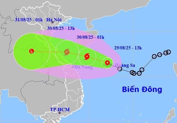
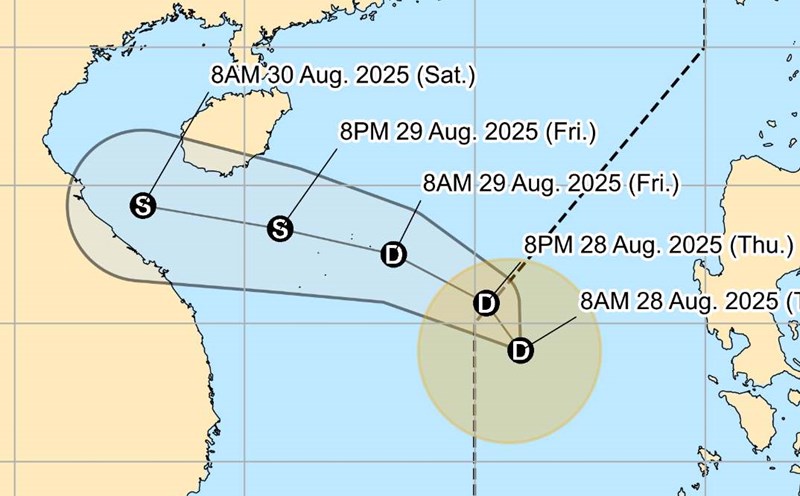
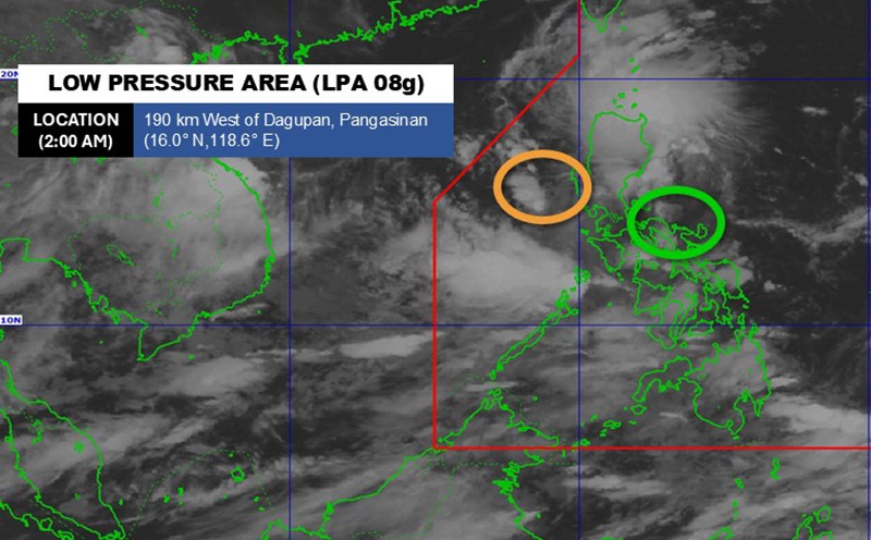
According to the latest storm news from the National Center for Hydro-Meteorological Forecasting, at 1:00 p.m. on August 29, the center of the tropical depression was at about 16.5 degrees North latitude - 112.1 degrees East longitude, in the waters of the Hoang Sa archipelago. The tropical depression is about 630km east-southeast of North Quang Tri, about 450km east of Hue city.
The strongest wind near the center of the tropical depression is level 7 (50-61km/h), gusting to level 9. The low pressure is moving northwest at a speed of 20-25km/h.

It is forecasted that by 1:00 a.m. on August 30, the tropical depression in the East Sea will have strengthened into a storm. The center of the storm is located at about 17.2 degrees North latitude - 109.8 degrees East longitude, in the sea area from Quang Tri to Da Nang, about 360km North of Quang Tri to East Southeast.
The strongest wind near the storm center is level 8, gusting to level 10. Natural disaster risk level: level 3 for the northwestern sea of the East Sea, from Quang Tri to Da Nang.
At 1:00 p.m. on August 30, the center of the storm was at about 17.7 degrees North latitude - 107.5 degrees East longitude, in the sea from Nghe An to Hue. The strongest wind near the storm center is level 8, gusting to level 10. Natural disaster risk level: level 3 for the area from Thanh Hoa to Hue, including Hon Ngu island and Con Co.
It is forecasted that by 1:00 a.m. on August 31, the center of the storm will be at about 17.8 degrees North latitude - 103.5 degrees East longitude, on the mainland of Central Laos - Thailand. The strongest wind near the storm center is less than level 6.
Due to the influence of the storm, the northwestern sea area of the East Sea (including the Hoang Sa archipelago): strong winds of level 6-7, near the center of the storm level 8, gusting to level 10. Waves are 2.0-5.0m high, with rough seas.
From the night of August 29, the sea area from Thanh Hoa to Da Nang (including Hon Ngu, Con Co): winds will gradually increase to level 6-7, near the storm center level 8, gusting to level 10. Waves 2.0-4.0m high, near the center of the storm 3.0-5.0m, rough seas. The coastal area from Nghe An to Hue will have water rising 0.2-0.4m.
From noon on August 30, the coastal area from Nghe An to Quang Tri will have strong winds of level 6, gusting to level 8. In particular, Ha Tinh - North Quang Tri: strong winds of level 6-7, near the storm center of level 8, gusting to level 10.
From the night of August 29 to the end of August 31, the area from Thanh Hoa - Hue will have heavy to very heavy rain, commonly 200-350mm, some places will have 600mm.
From 30-31.8, the midlands, Northern Delta and Da Nang will have moderate rain, heavy rain, some places very heavy; common rainfall is 100-200mm, some places are larger than 400mm.
People and tourists planning to visit areas affected by the storm should pay attention to weather forecasts. Proactively check flight schedules to have a reasonable travel plan. Tuan follows local instructions to ensure safety.


