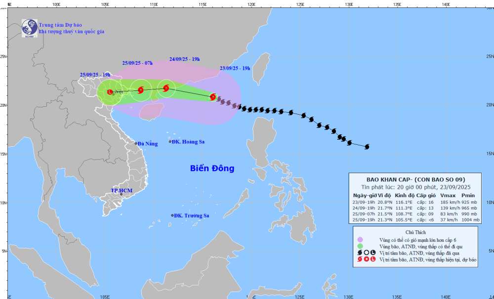
According to the latest storm news from the National Center for Hydro-Meteorological Forecasting, tomorrow, September 24, super typhoon Ragasa will officially make landfall in Guangdong province (China).
It is forecasted that by 7:00 p.m. on September 24, the super typhoon will move in a West-Northwest direction at a speed of about 20-25km/h and gradually weaken. The center of the storm is located at about 21.7 degrees North latitude - 111.3 degrees East longitude, on the mainland along the coast of Guangdong province (China); about 350km east of Mong Cai ( guangning).
The strongest wind near the storm center is level 13, gusting to level 16. Natural disaster risk level: level 4 for the northern sea area of the North East Sea; level 3 for the east of the North of the Gulf of Tonkin.
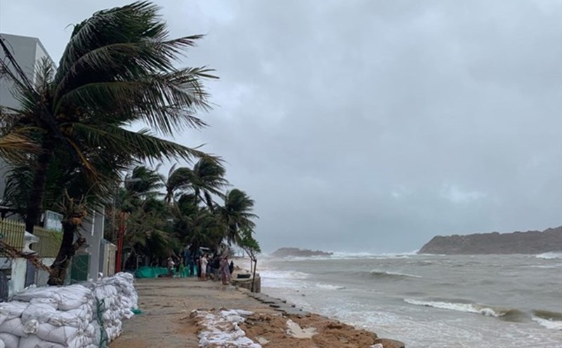
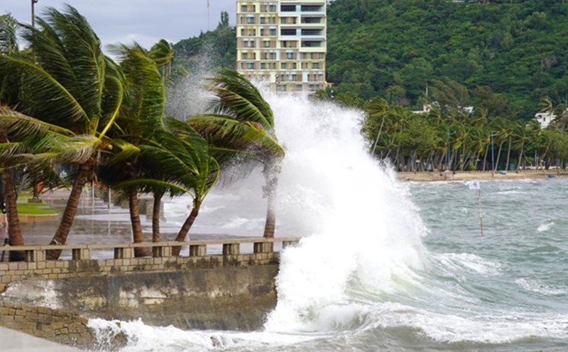
Due to the influence of the super typhoon, the eastern sea area of the Gulf of Tonkin (including the Bach Long Vy special zone) will have winds gradually increasing to level 6-7, gusting to level 9.
From the evening and night of September 24, the Gulf of Tonkin (including Bach Long Vy, Van Don, Co To, Cat Hai and Hon Dau island) will gradually increase to level 8-9, waves 2-4m high, the area near the storm's eye will have strong winds of level 10-12, gusts of level 14, waves 4-6m high, and rough seas.
Meanwhile, the tropical depression outside the East Sea will strengthen into a storm tomorrow, September 24. The Philippine Atmospheric, Geophysical and Astronomical Services Administration forecasts that the storm will enter the East Sea on September 27 and become the 10th storm.
The storm is forecast to move north, towards the North and the southern part of China. However, the US Meteorological Agency said that the storm will move into the Central region, focusing on the provinces from Ha Tinh to Quang Ngai.
Weather forecast for tomorrow, September 24:
Hanoi City
Lowest temperature: 25-27 degrees Celsius.
Highest temperature: 33-35 degrees Celsius.
Cloudy, scattered showers and thunderstorms at night, sunny during the day.North to northwest wind level 2-3.
Northwest
Lowest temperature: 23-26 degrees Celsius, some places below 22 degrees Celsius.
Highest temperature: 32-35 degrees Celsius.
Cloudy, scattered showers and thunderstorms at night, locally heavy rain, sunny during the day.Light wind.During thunderstorms, there is a possibility of tornadoes, lightning and strong gusts of wind.
Northeast
Lowest temperature: 24-27 degrees Celsius, mountainous areas below 24 degrees Celsius.
Highest temperature: 32-35 degrees Celsius.
Cloudy, scattered showers and thunderstorms at night, sunny during the day.North to northwest wind level 2-3.During thunderstorms, there is a possibility of tornadoes, lightning and strong gusts of wind.
Thanh Hoa to Hue
Lowest temperature: 24-27 degrees Celsius.
Highest temperature: 31-34 degrees Celsius.
Cloudy, scattered showers and thunderstorms at night, locally heavy rain; showers and thunderstorms in some places during the day.North to northwest wind level 2-3.During thunderstorms, there is a possibility of tornadoes, lightning, hail and strong gusts of wind.
South Central Coast
Lowest temperature: 24-27 degrees Celsius.
Highest temperature: 31-34 degrees Celsius, some places above 34 degrees Celsius.
Cloudy, scattered showers and thunderstorms; scattered showers and thunderstorms at night in the North, locally heavy rain.West to southwest wind level 2-3.During thunderstorms, there is a possibility of tornadoes, lightning, hail and strong gusts of wind.
Central Highlands
Lowest temperature: 19-22 degrees Celsius.
Highest temperature: 25-28 degrees Celsius.
Cloudy, rain, moderate rain and scattered thunderstorms, locally heavy to very heavy rain.Southwest wind level 2-3.During thunderstorms, there is a possibility of tornadoes, lightning, hail and strong gusts of wind.
Southern region
Lowest temperature: 23-26 degrees Celsius.
Highest temperature: 30-33 degrees Celsius.
Cloudy, the West has scattered showers and thunderstorms, especially in the late afternoon and evening there are scattered showers and thunderstorms, locally heavy rain; the East has rain, moderate rain and scattered thunderstorms, locally heavy to very heavy rain (rain concentrated in the late afternoon and night).Southwest wind level 3.During thunderstorms, there is a possibility of tornadoes, lightning, hail and strong gusts of wind.
Ho Chi Minh City
Lowest temperature: 24-26 degrees Celsius.
Highest temperature: 31-33 degrees Celsius.
Cloudy, rain, moderate rain and scattered thunderstorms, locally heavy rain (rain concentrated in the late afternoon and night).Southwest wind level 3.During thunderstorms, there is a possibility of tornadoes, lightning, hail and strong gusts of wind.