According to storm news, the latest low pressure from the Joint Typhoon Warning Center, 2 new low pressures have formed in the Pacific Ocean.
The first low pressure bears the symbol Invest 91E, currently located in the sea off the southern coast of Mexico. The strongest wind near the low pressure center reaches 35 km/h. has a 70% chance of strengthening into a tropical cyclone
The low pressure has a 40% chance of strengthening into a tropical depression or tropical storm in the next 48 hours and increasing to 70% in the next 7 days.
The low pressure is forecast to move slowly in a Northeast or North direction, along the southern coastal area of Mexico.
Meanwhile, another low pressure area operating off the coast of Central America, south of El Salvador, is causing sea thunderstorms.
This low pressure has a 30% chance of strengthening into a tropical depression or tropical storm in the next 48 hours and increasing to 60% in the next 7 days.
If it continues to be maintained at sea, this low pressure area may strengthen into a tropical depression by the end of this week or early next week. It is forecast that the low pressure area will move slowly in a northerly direction, moving closer to the coast of Central America.
Whether it develops into a tropical depression or not, this low pressure area still has the potential to cause localized heavy rain in some areas of Nicaragua, El Salvador and Guatemala in the coming days.
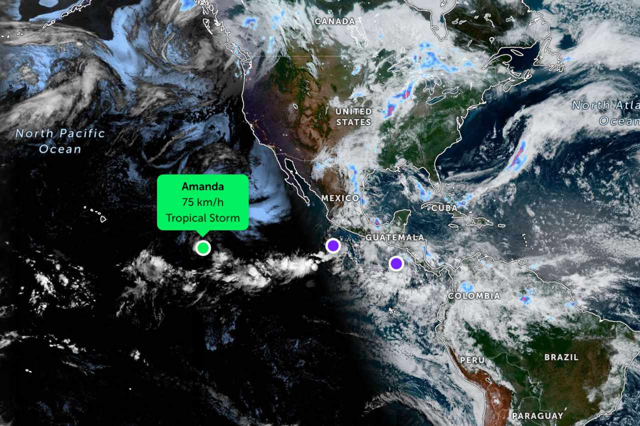
In another development, storm Amanda is gradually weakening in the Pacific Ocean. The strongest wind near the storm center is 75 km/h.
In terms of trajectory, storm Amanda is currently moving in a West-Northwest direction at a speed of about 15 km/h. Under the impact of a subtropical high pressure area in the Northwest, the storm is forecast to gradually move westward on June 5-6 and then change direction to Southwest on June 7.
The storm is forecast to weaken into a low pressure area in the next 60 hours.
People and tourists planning to visit areas affected by storms and low pressures should pay attention to weather forecasts. Avoid going out to sea when the sea is rough and follow local instructions to ensure safety throughout the journey.


