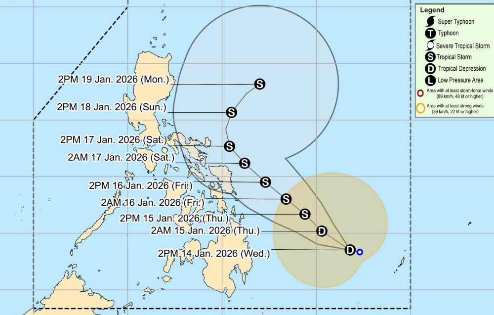
According to the latest weather forecast from the Philippine Atmospheric, Geophysical and Astronomical Services Administration (PAGASA), on the afternoon of January 14, tropical depression Ada approached the mainland of the Philippines.
As of 4 pm today (local time), the center of the low pressure is located at about 8.2 degrees North latitude - 131.3 degrees East longitude, about 545 km east of Hinatuan, Surigao del Sur. The tropical depression is moving in the Northwest direction at a speed of about 10 km/h.
The strongest wind near the center of the low pressure reached 45 km/h, gusting up to 55 km/h. The low pressure is forecast to strengthen into a storm in the afternoon of tomorrow, January 15, then continue to move in a Northwest direction, closely following the mainland of the Philippines for the next 3 days. Next, the storm will change direction to the Northeast, gradually moving away from the mainland of the Philippines.
Due to the influence of the tropical depression, from tomorrow afternoon, January 15, heavy rain from 100-200mm will occur in North Samar, East Samar, Camarines Sur, Catanduanes, Albay, Sorsogon. Eastern Samar area, Dinagat Islands, Surigao del Surigao del Norte, Catanduanes, Albay, Sorsogon, Biliran, Leyte, South Leyte, Dinagat Islands will have rain from 50-100 mm.
Heavy rain can cause flooding in urbanized areas, low-lying areas or near rivers, along with a high risk of landslides.
If the tropical depression Ada strengthens into a storm, this will be the first tropical storm of the Philippines in 2026. PAGASA forecasts that about 0-1 storms will make landfall in the country in January.
People and tourists planning to come to the Philippines during this time should pay attention to weather forecasts. Check flight schedules and follow local instructions to ensure safety.


