According to the latest update on the tropical depression near the East Sea from the National Center for Hydro-Meteorological Forecasting, on the afternoon of December 7, the center of the tropical depression was at about 12.0 degrees North latitude; 123.5 degrees East longitude, in the mainland area of the central Philippines.
The strongest wind near the center reaches level 6 (39-49 km/h), gusting to level 8. The system is moving west at a speed of about 15 km/h.
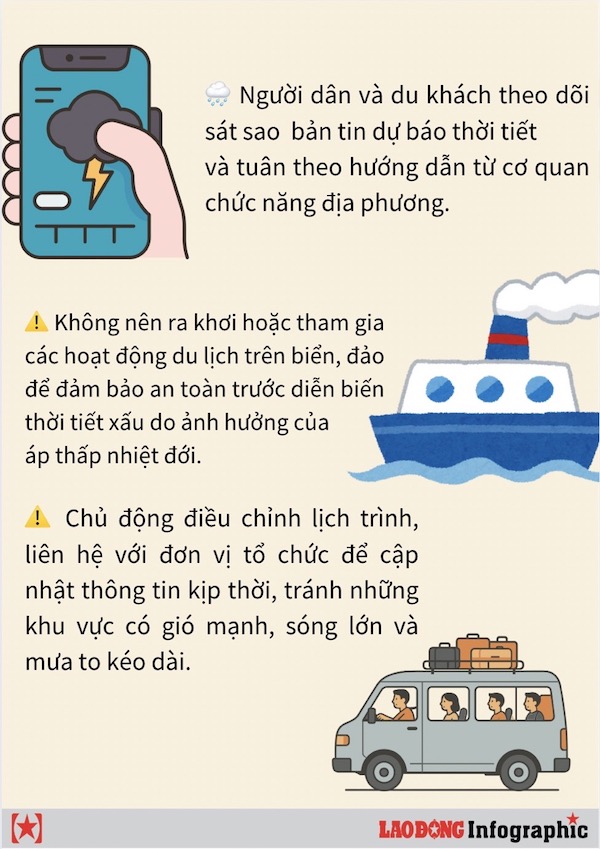
This is an important development in the tropical depression bulletins that coastal residents and tourists need to monitor continuously.
In the next 24-48 hours, the tropical depression will continue to move in the West Southwest direction into the East Sea.
By 1:00 p.m. on December 18, the tropical depression is forecast to move at a speed of 15-20 km/h. The center of the tropical depression is estimated at about 11.6 degrees North latitude; 119.8 degrees East longitude, in the area north of Palawan Island (Philippines), the intensity remains at level 6, gusting to level 8. The natural disaster risk level reached level 3, affecting the southeastern sea area in the central East Sea.
At 1:00 p.m. on December 9, the system continued to move in the West Southwest direction at a speed of about 20 km/h and was located at about 10.8 degrees North latitude; 115.4 degrees East longitude, in the northern sea area of Truong Sa province, about 140 km East Southeast of Song Tu Tay island. Maintain intensity level 6, gust level 8.
The danger zone is determined to be from 10.00 to 12.50 degrees North latitude and east of 115.50 degrees East longitude. The natural disaster risk level continues to be at level 3 for the southern sea area of the central East Sea, including the northern sea area of Truong Sa province.
In the next 48-72 hours, the tropical depression will move in a West-Southwest direction at a speed of 20-25 km/h and tend to weaken gradually.
On the night of December 7 and December 8, the North East Sea area (including Hoang Sa special zone) has strong winds of level 6, sometimes level 7, gusting to level 8-9. Strong seas. The wind is blowing northeast, with waves 4.0-6.0 m high.
At the same time, the area between the East Sea and the sea from Da Nang to Dak Lak will have winds gradually increasing to level 6, gusting to level 7-8, rough seas. The main wind direction is Northeast, with wave height ranging from 4.0-6.0 m.
The sea area from Khanh Hoa to Ca Mau and the west of the South East Sea (including the sea area west of Truong Sa) will have strong winds of level 6, sometimes level 7, gusting to level 8-9. Strong sea, northeast wind dominates, waves 3.0-5.0 m high.
The southeastern sea area between the East Sea and the South East Sea area (including Truong Sa special zone) will have scattered showers and thunderstorms. During thunderstorms, there is a possibility of tornadoes and strong gusts of wind of level 6-7.
On the night of December 8 and December 9, the North East Sea area (including Hoang Sa special zone) will continue to have strong Northeast winds of level 6, sometimes level 7, gusting to level 8-9. The waves remained at 4.0-6.0 m high, with rough seas.
The central East Sea area (including the sea area north of Truong Sa special zone) and the sea area from South Quang Tri to Dak Lak have strong northeast winds of level 6, gusting to level 7-8. Waves are 3.0-5.0 m high, rough seas.
The sea area from Khanh Hoa to Ca Mau and the western sea area of the South China Sea (including the western sea area of Truong Sa) will have strong northeast winds of level 6, sometimes level 7, gusting to level 8-9. Waves are 3.0-5.0 m high, with rough seas.
The risk level of natural disasters at sea is level 2; especially from the morning of December 8, the southeastern sea area in the central East Sea is level 3.