The US National Hurricane Center (NHC) has just issued an update on the weather situation in the Atlantic and Gulf of Mexico, pointing out three notable areas with the potential to form storms in the coming days.
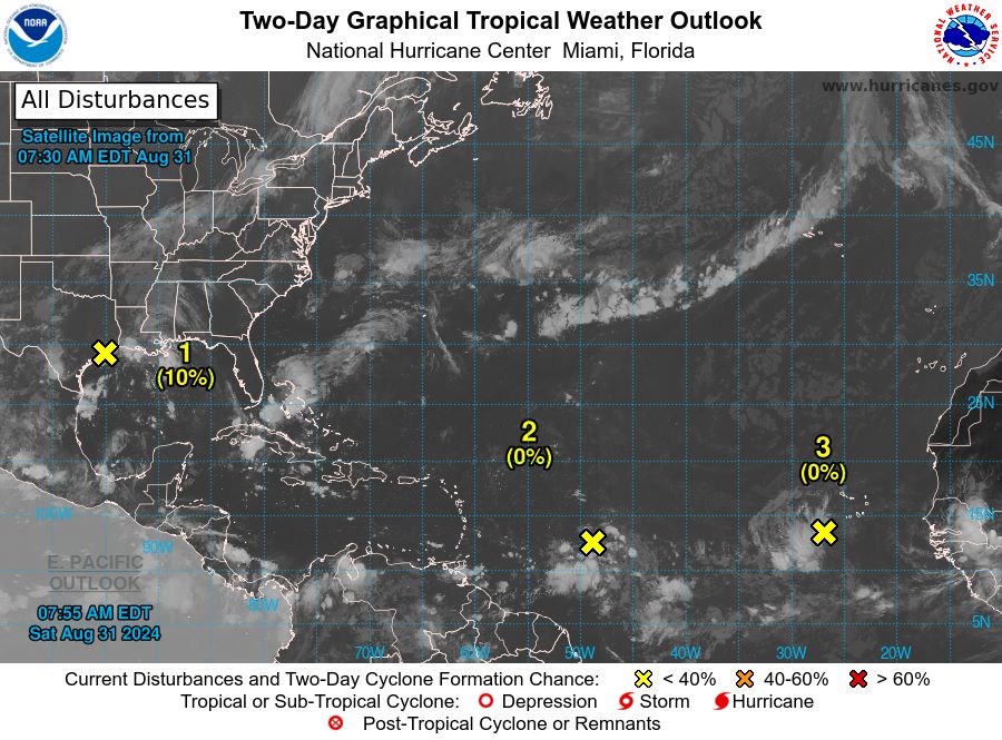
In the northwestern Gulf of Mexico, a large area of low pressure is forming near the upper Texas coast, bringing some scattered showers and thunderstorms along and just off the Texas and Louisiana coasts.
The system is forecast to remain near the coast for much of next week and is likely to develop slowly as it moves offshore. The chance of formation in the next 48 hours is 10% and in the next 7 days is 20%.
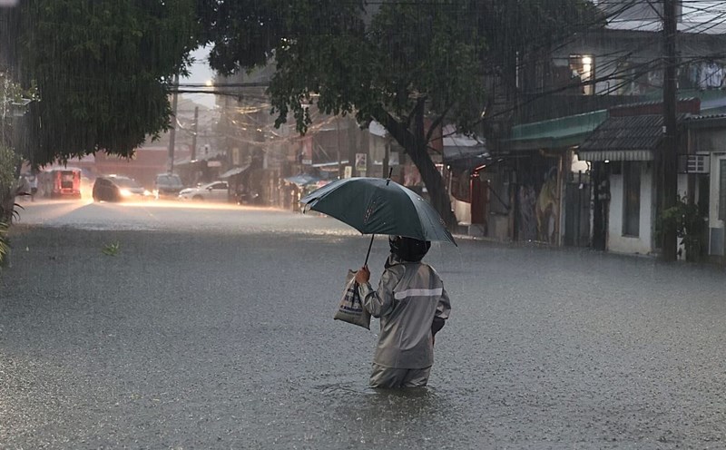
Notably, heavy rain could cause some flash flooding in parts of coastal Louisiana and the upper Texas coast over the next few days.
Near the Lesser Antilles and the Caribbean Sea, a tropical wave is located a few hundred miles east of the Lesser Antilles, producing some scattered showers and thunderstorms.
The disturbance is forecast to move westward and reach the Lesser Antilles by Monday. After that, environmental conditions appear favorable for the system to gradually develop. The chance of formation in the next 48 hours is nearly 0%, but increases to 50% over the next 7 days.
Finally, in the eastern tropical Atlantic, another tropical wave just west of the Cape Verde Islands is bringing unusual showers and thunderstorms.
Development, if any, will be slow as the system moves slowly westward to west-northwestward through the eastern and central tropical Atlantic through late next week. The chance of formation in the next 48 hours is nearly 0% and in the next 7 days is 10%.
Visitors and residents in these areas are advised to monitor weather updates regularly from official sources, consider adjusting travel schedules if necessary, have a contingency plan and emergency supplies ready, and follow all instructions and warnings from local authorities.
In particular, pay attention to flash flood warnings for coastal areas of Louisiana and Texas, and be alert for the potential for storm surge and high surf if you are in coastal areas.