According to information from the Joint Typhoon Warning Center (JTWC), the low pressure bearing the symbol Invest 91W is currently operating at sea, after leaving mainland Taiwan (China)
In the Philippines, this low pressure is identified as a tropical depression, named locally Ester. After leaving mainland Taiwan (China), it is forecast that the low pressure will continue to move quickly in the North - Northeast direction through the East China Sea.
The strongest wind near the center of the low pressure reached 45 km/h. Forecast models show that the low pressure may reach its strongest intensity in the next 18 hours when passing through western Okinawa Island of Japan. After that, the circulation is forecast to expand, but the structure will become more subtropical or extratropical instead of developing into a typical tropical storm.
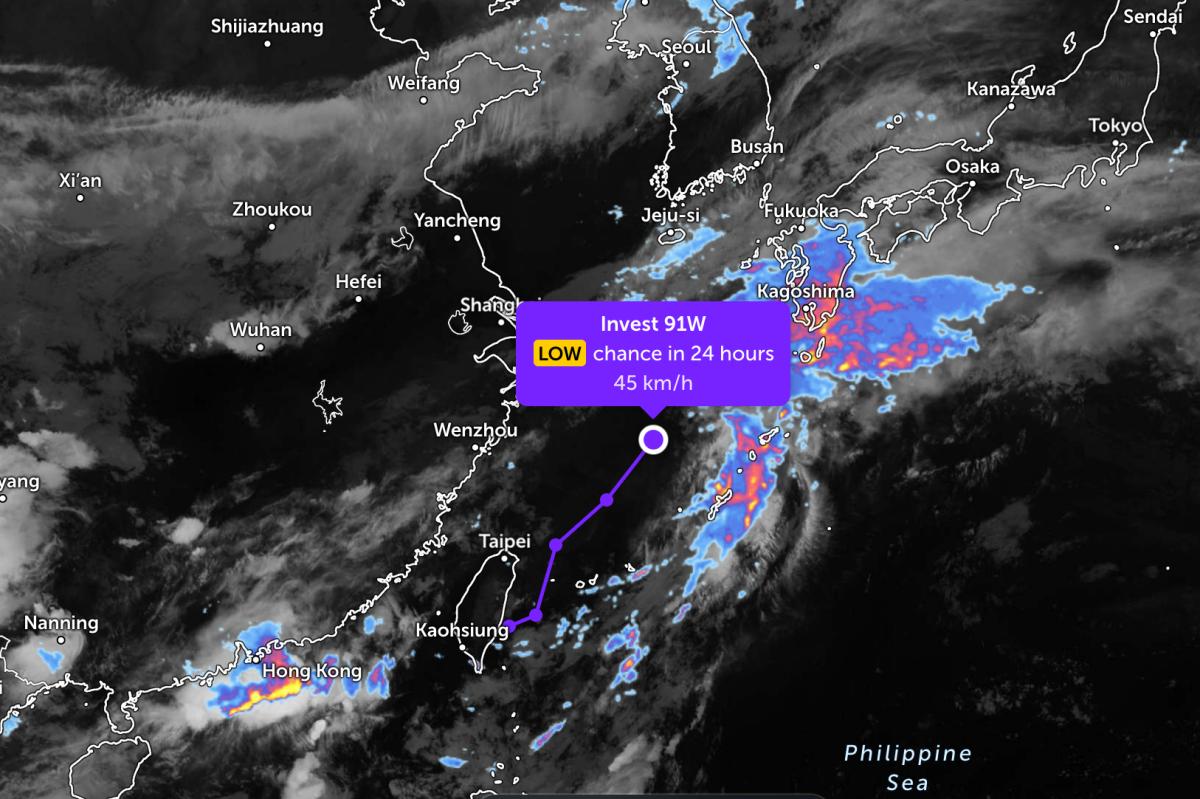
The low pressure area tends to move towards Japan, so it is assessed that it is unlikely to return to the East Sea and directly affect Vietnam's mainland.
In the East Sea, according to the National Center for Hydro-Meteorological Forecasting, on the night of June 6, the sea area east of the Northern and Central East Sea, the sea area from Ho Chi Minh City to Ca Mau, from Ca Mau to An Giang and the Gulf of Thailand will have scattered showers and thunderstorms. In thunderstorms, there is a possibility of tornadoes, strong gusts of wind at level 7-8.
The northeastern sea area of the Northern East Sea, from Khanh Hoa to Lam Dong, has strong southwest winds of level 5, sometimes level 6, gusts of level 7. Sea is rough. Sea waves are 1.5-2.5m high; especially the Central East Sea area is 2.0-3.0m.
All ships operating in the above areas are at risk of being affected by tornadoes, strong gusts of wind and high sea waves.
People and tourists planning to visit these sea areas should pay attention to weather forecasts and follow local instructions to ensure safety throughout the journey.


