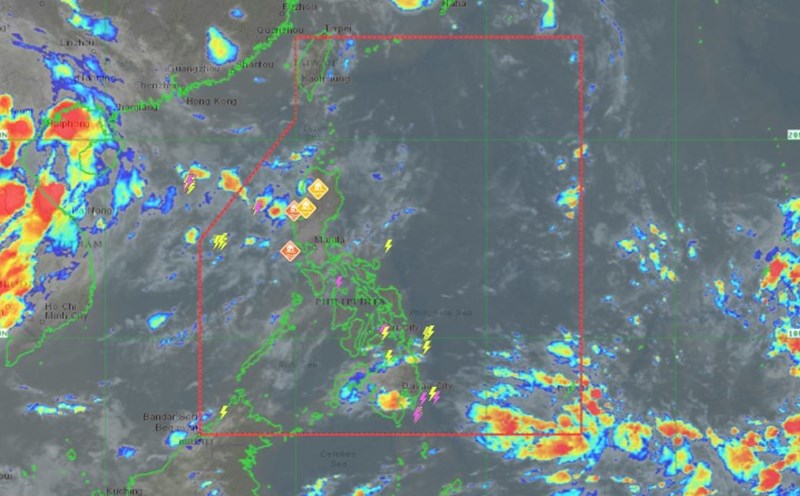
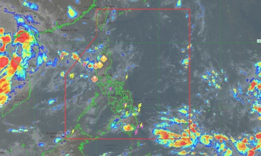
According to the Philippine Atmospheric, Geophysical and Astronomical Services Administration (PAGASA), as of 8:00 a.m. on September 16 (local time), the center of low pressure Gener was estimated to be located about 315 km east-northeast of Casiguran, Aurora.
The tropical depression is moving west at 10 km/h, with the strongest wind near the center remaining at 45 km/h and gusting up to 55 km/h.
PAGASA said tropical depression Gener is expected to enter Isabela or Aurora within 24 hours.
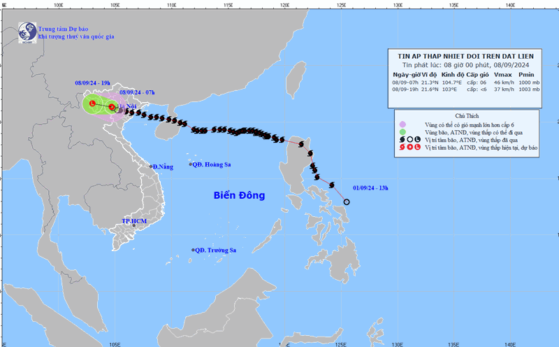
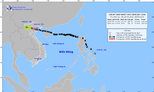
According to the forecast track, Tropical Depression Gener may exit the Philippine Area of Responsibility on September 18. In waters west of the Philippine Forecast Area (PAR), Gener is expected to intensify into a typhoon as it enters the South China Sea. It will then weaken as it approaches Hainan, China, late on September 20 to early on September 21.
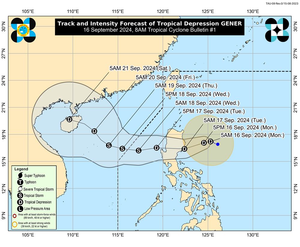
The tropical depression then continues to move into the Gulf of Tonkin. However, as the tropical depression moves through an area close to the Luzon land mass, its intensity and path are likely to change.
According to the forecast of the Japan Meteorological Agency (JMA), tropical depression Gener will enter the Gulf of Tonkin on September 21. At that time, this tropical depression will have winds of 72 km/h (level 8), gusts of 108 km/h (level 11).
If tropical depression Gener strengthens into a storm, it will be named Soulik. This could be the fourth storm to make landfall in Vietnam this year.
Tourists planning to travel to areas likely to be affected by this tropical depression should regularly update weather forecasts, announcements from airlines and tour operators to proactively change their schedules when necessary.