According to storm news, the latest low pressure from the Philippine Atmospheric, Geophysical and Astronomical Services Administration (PAGASA), a low pressure has moved closer to the East Sea.
As of 2 am this morning local time, the center of the low pressure was located at about 7.5 degrees North latitude - 154.4 degrees East longitude, about 3,095 km east of the Northeast of Mindanao.
The strongest wind near the center of the low pressure reached 30 km/h. The low pressure is highly likely to strengthen into a tropical depression in the next 24 hours.
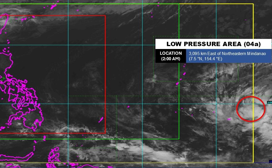
Due to being far from the mainland, the low pressure has not significantly affected the weather on the islands of the Philippines.
In the East Sea, according to the National Center for Hydro-Meteorological Forecasting, on April 8, the Gulf of Tonkin area (including the North and South Gulf) will have showers and thunderstorms in some places, visibility over 10km; South to Southeast wind level 4-5, especially in the North of the Gulf in the evening and night sometimes increasing to level 6, gusts level 7-8, rough seas with waves 1.5-2.5m high, while in the South waves are lower than 1.0-2.0m.
In the central coastal strip from Quang Tri to Khanh Hoa, the weather is generally dry, no rain, good visibility; mainly wind level 3-5, sea waves commonly 1.5-2.0m, relatively favorable conditions.
The South Central Coast and Southern regions (from Lam Dong to Ca Mau, Ca Mau to An Giang and the Gulf of Thailand) maintain a stable state, no rain, light wind, calm sea with low waves of 0.5-1.5m.
The Northern East Sea area has scattered showers and thunderstorms, wind level 4-5, highest waves 2.0-3.0m; while the remaining areas including Hoang Sa, central and Southern East Sea, Truong Sa mostly no rain, light wind to level 4, waves fluctuating 0.5-2.5m, the sea is relatively stable.
People and tourists planning to visit these sea areas should pay attention to weather forecasts. Follow local instructions and avoid going to sea when the sea is rough to ensure safety.


