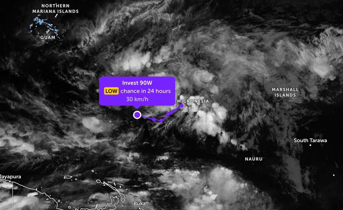
According to the latest low pressure and storm bulletin from the Joint Typhoon Warning Center (JTWC), two storms and one low pressure are operating in the Pacific Ocean.
As of the afternoon of April 7, the low pressure bearing the symbol Invest 90W is currently located in the western Pacific region. The strongest wind near the center of the low pressure reaches 30 km/h.
The low pressure is unlikely to develop into a tropical depression in the next 24 hours, but the weather in the vicinity will still have thunderstorms due to the influence of this system.
Meanwhile, Typhoon Vaianu continues to strengthen in the Pacific Ocean. The center of Typhoon Vaianu is currently located about 348 km west-southwest of Suva (Fiji). In the past 6 hours, the typhoon has moved in the South - Southeast direction at a speed of 22 km/h. The maximum wave height reached 12.2 m.
The strongest wind near the storm center reached 185 km/h. It is forecasted that in the next 2 days, the storm will strengthen fiercely, then gradually weaken into a tropical depression.
Off the coast of Australia, storm Maila is currently located about 1,235 km south of Kapingamarangi (Australia). In the past 6 hours, the storm has moved in the East - Southeast direction at a speed of 4 km/h. The maximum wave height reached 9.8 m. The strongest wind near the storm center reached 165 km/h.
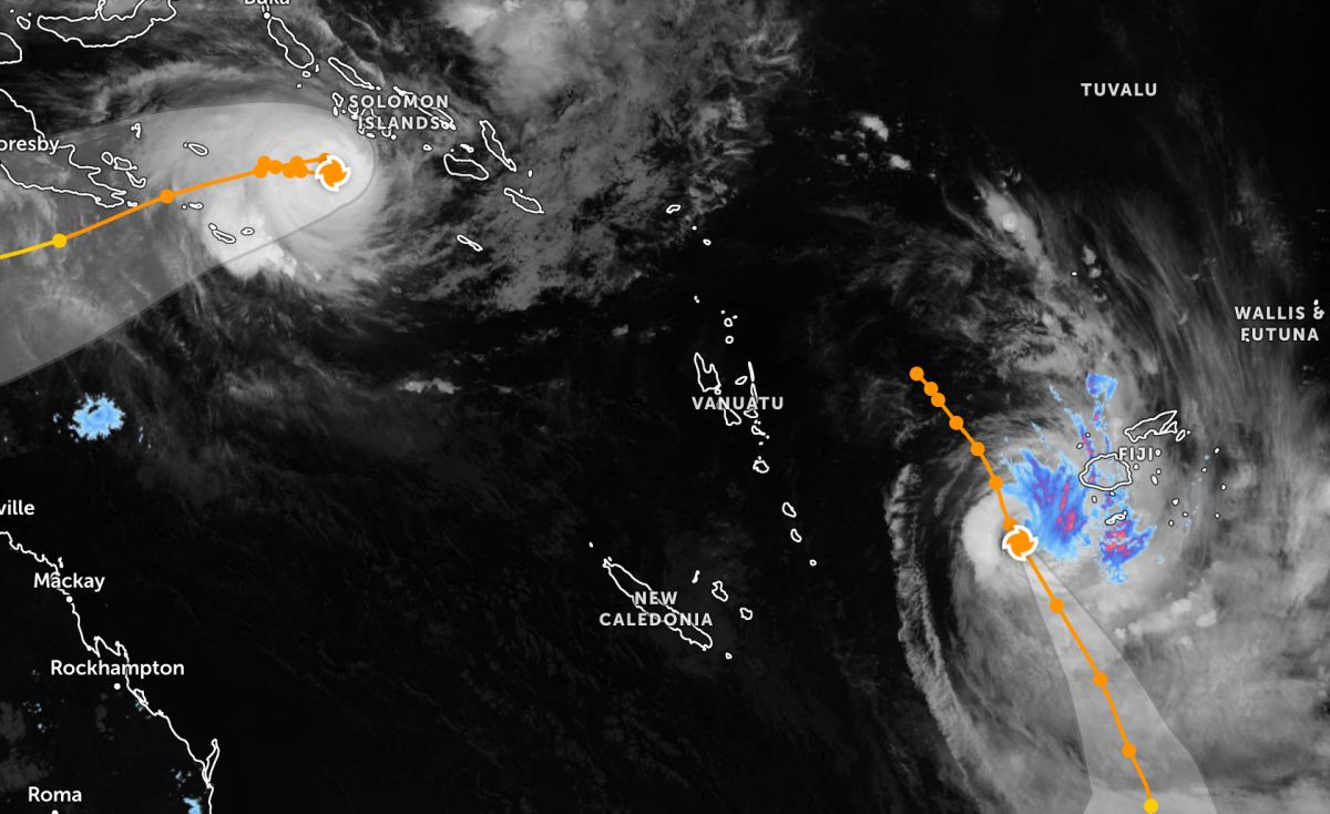
The storm is forecast to move in a West-Southwest direction for the next 5 days, before gradually weakening.
Because it is still quite far from the mainland, storms and low pressures have not caused much impact on the surrounding archipelagos. However, people and tourists with sea routes and flights through storm and low pressure areas such as Fiji, Solomon Islands, northern Australia... should pay attention to weather forecasts. Follow the instructions of local authorities to ensure safety.


