In its 11 a.m. storm update on October 27, PAGASA said tropical storm Leon (international name: Kong-rey) is being monitored, with its center 1,075 km east of Central Luzon.
“This tropical storm is expected to gradually intensify over the next 24 hours and may reach severe tropical storm status tomorrow (October 28) and typhoon status on Tuesday (October 29),” PAGASA reported.
Typhoon Leon remains far from the Philippines, with maximum sustained winds of 65 km/h and gusts of up to 80 km/h. The storm is moving at a fairly fast speed of about 30 km/h, with the area of strong winds extending 560 km from the center of the storm.
The storm is expected to affect the southwest monsoon flow, possibly affecting Visayas, Mindanao and the western part of southern Luzon.
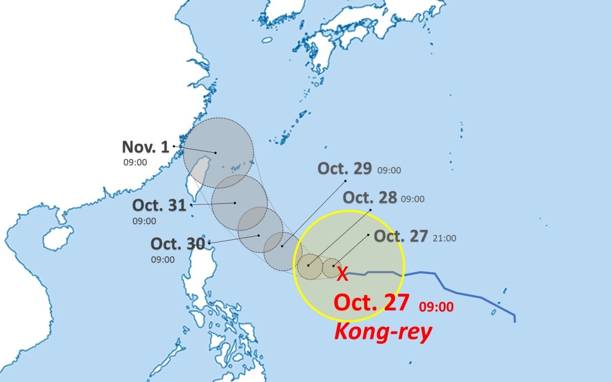
Taiwan's meteorological agency is also monitoring the storm. Tropical Storm Kong-Rey is expected to begin moving north in the coming days into the waters east of Taiwan and bring heavy rain to northern areas of the island from October 30.
In its seven-day forecast, the China Weather Administration (CWA) said the island will see scattered showers throughout next week.
The Japan Meteorological Association forecasts that Typhoon Kong-rey will move west-northwest toward the east of the Philippines at 3 p.m. on October 30 and reach southern Okinawa at 3 p.m. on October 31.
Residents and tourists in Japan are urged to be on high alert, as areas affected by the typhoon will experience heavy rain and wind, while the sea areas through which the storm passes will also experience large waves and rough seas.
