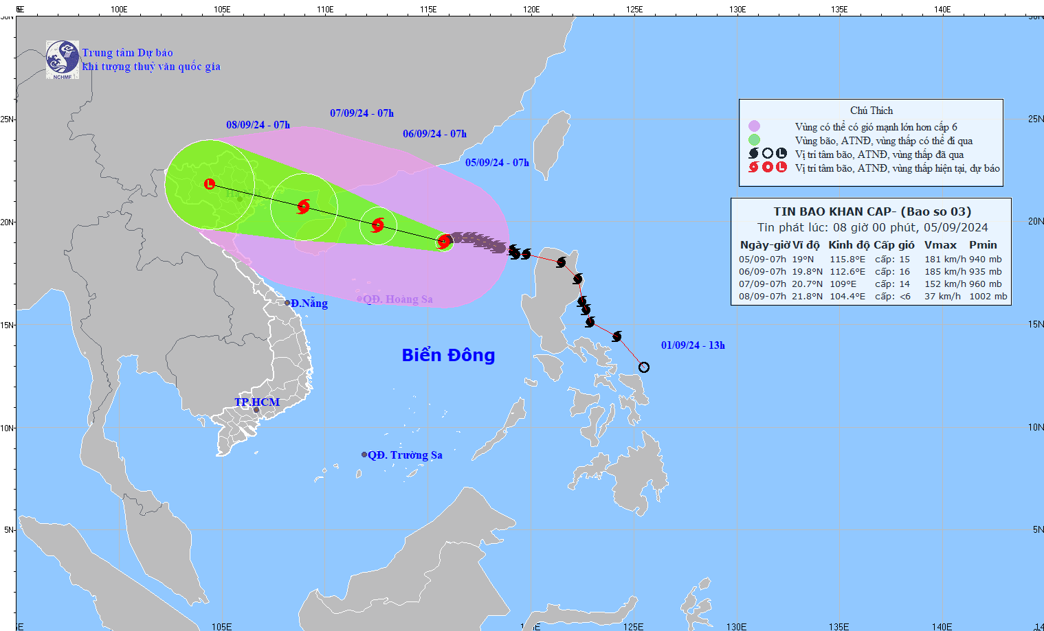
The National Center for Hydro-Meteorological Forecasting said that the intensity of storm No. 3 has approached the level of a super storm (late level 15, early level 16). The agency is considering raising the disaster risk warning to level 5 (disaster level).
At 10:00 a.m. this morning, the center of the storm was at approximately 19.1 degrees North latitude; 115.5 degrees East longitude, in the northern sea area of the North East Sea, approximately 520km east of Hainan Island (China).
The strongest wind speed reaches Level 16 (184-201km/h), gusting above Level 17. It is forecasted that in the next 3 hours, the storm will move westward at a speed of about 10km/h.
Storm No. 3 Yagi is forecast to make landfall around the evening of September 7. This could be the strongest storm to hit the North in the past 10 years, as domestic and international meteorological agencies have predicted that the storm could reach level 15 or higher.
From the night of September 6-9, the Northern and North Central regions are likely to experience heavy rain, locally very heavy rain and thunderstorms with total rainfall ranging from 100-300mm, in some places over 500mm.
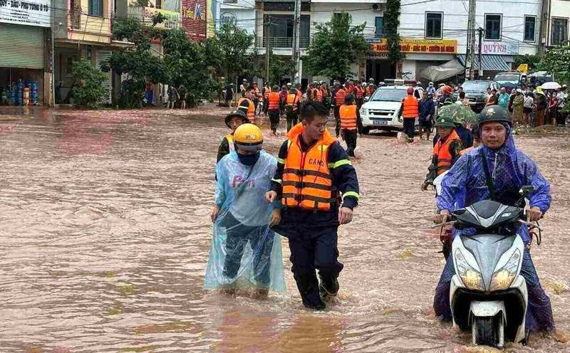
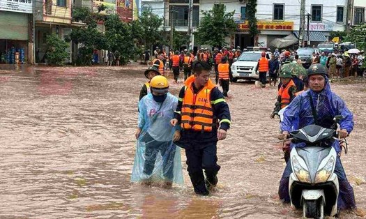
Heavy rains are likely to cause flooding in low-lying areas; flash floods in small rivers and streams; and landslides on steep slopes. Due to the influence of the wide storm circulation, it is necessary to be on guard against the risk of thunderstorms, tornadoes, and strong gusts of wind both before and during the storm.
Early in the morning of September 7, coastal areas from Quang Ninh to Thanh Hoa provinces had winds gradually increasing to level 6-7, then increasing to level 8-9, areas near the storm center had winds of level 10-12, gusting to level 14; areas deep inland in the Northeast had strong winds of level 6-8, gusting to level 9-11.
Coastal provinces from Thanh Hoa to Quang Ninh need to be on guard against storm surges of 0.5-1.8m: Quang Ninh from 1.5-1.8m; Hai Phong and Thai Binh from 1.2-1.5m; Nam Dinh and Ninh Binh from 0.8-1.2m; Thanh Hoa: 0.5-1.0m.
The North East Sea has strong winds of level 11-13, near the eye of the storm level 14-16, gusting to level 17; rough seas. From the night of September 6, the Gulf of Tonkin (including Bach Long Vi and Co To island districts) has winds gradually increasing to level 8-9, then increasing to level 10-12, near the eye of the storm level 13-14, gusting to level 17; rough seas.
Some localities in the North and North Central regions such as Quang Ninh, Hai Phong, Ninh Binh, Thanh Hoa... have issued urgent dispatches on implementing response work to storm No. 3 Yagi.
Accordingly, the People's Committee of Quang Ninh province requested the Department of Tourism to keep a close eye on the number of tourists, especially at coastal tourist areas; inform tourism businesses about the storm situation so that businesses can proactively prepare plans to welcome guests.
Hai Phong City People's Committee requests to count and notify by all means the owners of vehicles operating at sea to urgently move to safe shelters;... absolutely do not let people on boats, rafts, fishery watchtowers when there is strong wind or storms, especially tourists at sea and on islands.
Based on the storm's developments, proactively determine the time to announce a sea ban and temporarily suspend inland waterway transport activities, river bridges, cable car systems, and entertainment areas at coastal tourist areas.