According to the National Center for Hydro-Meteorological Forecasting, storm No. 3 has rapidly increased in intensity and is forecast to continue to increase in intensity within the next 24 hours.
Today it continues to strengthen and head towards the Gulf of Tonkin.
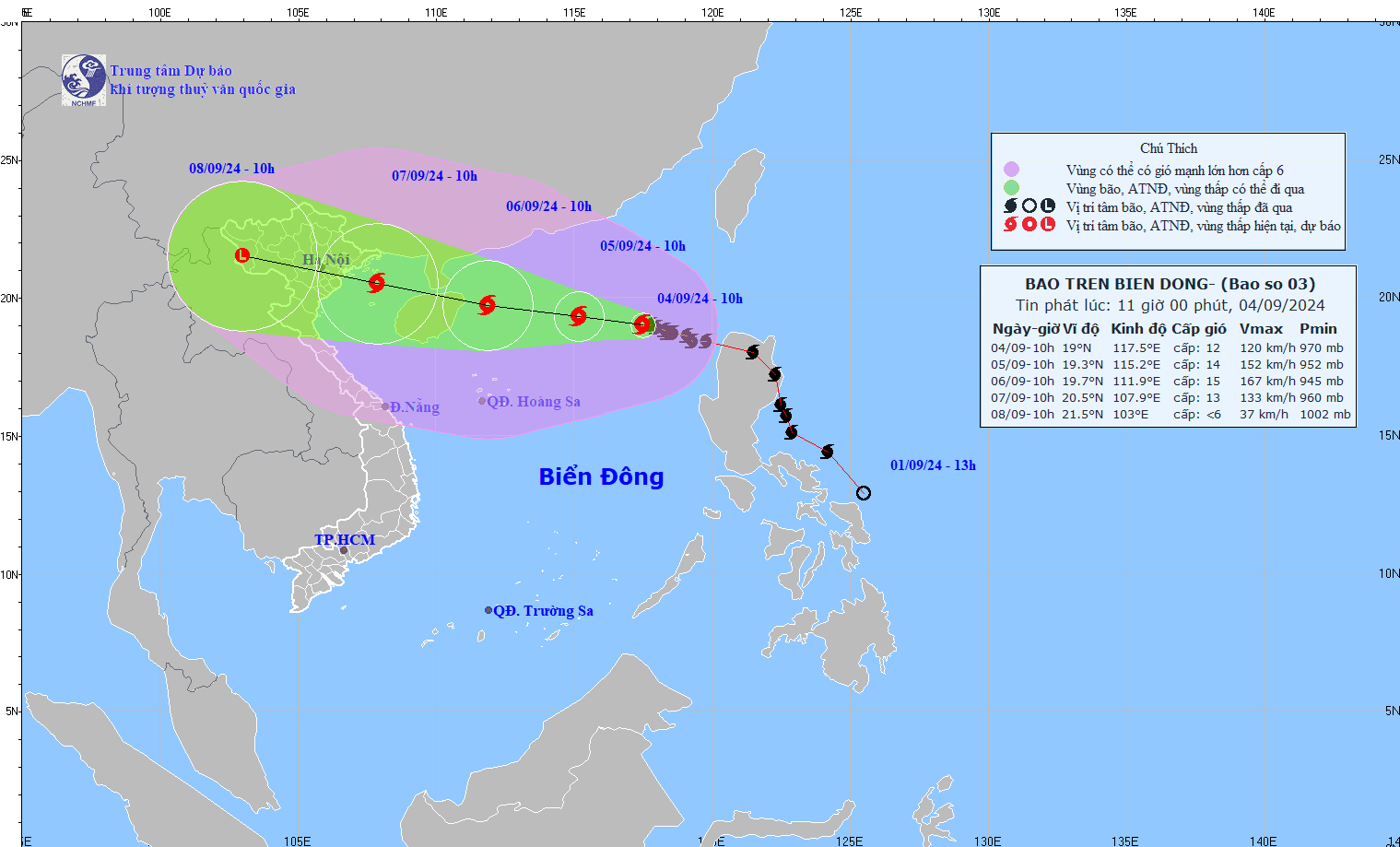
At 10:00 a.m. on September 4, the center of storm No. 3 was determined to be at about 19 degrees north latitude and 117.5 degrees east longitude, in the northeastern sea of the East Sea, about 730 km east of Hainan Island (China).
The strongest winds near the storm's center are currently at level 12 (118-133 km/h), with gusts as strong as level 15. The storm is moving west-northwest at about 10 km/h.
It is forecasted that in the next 24 hours, storm No. 3 will continue to move west-northwest at a speed of 10 - 15 km/h.
At 10:00 a.m. on September 5, the eye of the storm is expected to be at approximately 19.3 degrees north latitude and 115.2 degrees east longitude, approximately 470 km east of Hainan Island (China). The strongest winds near the eye of the storm could reach level 13-14, with gusts as strong as level 17.
In the next 48 hours, storm No. 3 will continue to move west-northwest at a speed of 10 - 15 km/h.
At 10:00 a.m. on September 6, the storm will be at about 19.7 degrees north latitude and 111.9 degrees east longitude, about 120 km east of Hainan Island. At this time, the strongest winds near the storm's center can reach level 14 - 15, with gusts as strong as level 17.
It is forecasted that in the next 72 hours, storm No. 3 will move west-northwest at a speed of 15 - 20 km/h.
By 10am on September 7, the storm could be at around 20.5 degrees north latitude and 107.9 degrees east longitude, in the Gulf of Tonkin. The strongest winds near the storm's eye could reach level 12-13, with gusts as strong as level 16.
From the next 72 to 120 hours, storm No. 3 will continue to move mainly in the west-northwest direction at a speed of about 15 - 20 km/h and its intensity is forecast to gradually decrease.
Regarding the impact of the storm, the North East Sea area is currently affected by strong winds of level 9-11, the area near the storm's center can reach level 12-14, with strong gusts of wind up to level 17 and violently rough seas.
From September 5 to 6, storm No. 3 may continue to increase in intensity, with strong winds reaching level 15, gusts above level 17 near the storm's center.
Over the next 24 hours, waves in the northeastern part of the East Sea may reach 5-7 meters high, and in the area near the storm center they may reach 7-9 meters. From September 5 to 6, waves may increase to 9-11 meters, with rough seas. Vessels operating in these dangerous areas need to pay special attention and may be affected by strong winds and large waves.
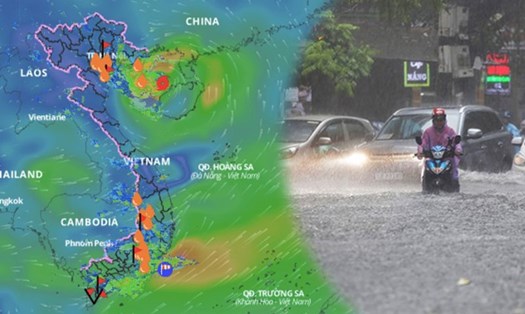
Tourists planning to travel to the North and North Central regions should consider their travel plans at this time as it is not the right time to travel. People and authorities need to closely monitor the storm’s developments and take necessary response measures to ensure safety.