According to the latest weather forecast from the Philippine Atmospheric, Geophysical and Astronomical Services Administration (PAGASA), as of 8:00 a.m. on November 11 (local time), the center of storm Toraji (local name: Nika) was located at about 16.0 degrees North latitude, 123.0 degrees East longitude, 100 km southeast of Casiguran, Aurora.
The storm is moving west-northwest at 15 km/h. The strongest winds near the center of the storm are maintained at 130 km/h, with gusts of up to 180 km/h. Typhoon Toraji has strengthened into a typhoon.

Typhoon Toraji is forecast to make landfall in Isabela or north of Aurora (Philippines) this morning, November 11. The storm is expected to move mainly west-northwest until November 14, before turning southwest from November 15 onwards.
PAGASA forecasts that the storm's strength could pose a danger over land and coastal waters in areas beyond the storm's landfall.
After making landfall, the storm will cross the Luzon mainland and appear in the sea west of Ilocos Sur tonight, November 11. The storm will continue to move west-northwest through the West Philippine Sea and exit the Philippine Area of Responsibility in the morning or afternoon of November 12, officially entering the East Sea, becoming the 8th storm of the 2024 storm season in Vietnam.
According to the National Center for Hydro-Meteorological Forecasting, as of 7:00 a.m. on November 12, the storm moved in a West-Northwest direction at a speed of about 20 km/h, entering the East Sea. The center of storm Toraji was located at about 18.6 degrees North latitude - 118.3 degrees East longitude, in the sea area east of the North East Sea. The strongest wind near the center of the storm was level 10, gusting to level 12. Disaster risk level: level 3 for the east of the North East Sea.
Forecast at 7am on November 13, the storm will continue to move in the West Northwest direction, slowing down to about 10-15 km/h. The center of storm Toraji is located at about 19.7 degrees North latitude - 116.0 degrees East longitude, in the sea area east of the North East Sea. The strongest wind near the center of the storm is level 10, gusting to level 12. Disaster risk level: level 3 for the east of the North East Sea.
As of 7:00 a.m. on November 14, the storm continued to move in a West-Northwest direction at a speed of about 10-15 km/h. The center of storm Toraji was located at about 20.4 degrees North latitude - 113.7 degrees East longitude, in the northern sea area of the North East Sea. The strongest wind near the center of the storm was level 8, gusting to level 10. Disaster risk level: level 3 for the northern part of the North East Sea area.

PAGASA forecasts that Toraji may weaken from a typhoon to a severe tropical storm as it crosses mainland Luzon due to land interaction. The storm will then gradually weaken until it becomes a low pressure area.
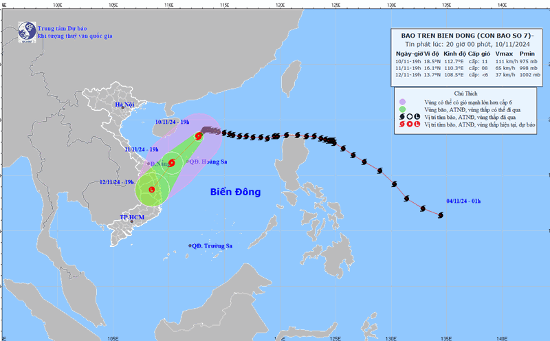
With storm No. 7 Yinxing moving across the East Sea and storm No. 8 approaching, people and tourists traveling to the Philippines and the Central region of Vietnam should pay attention to weather forecasts, check storm announcements from airlines, ships, and travel companies to arrange appropriate schedules and ensure safety.


