In a report from 0:00 to 4:00 a.m. on October 25, PCG said that 10,236 people were stranded due to the impact of the storm. A total of 2,699 cargoes were being transported, 96 boats and 17 motor bancas were forced to stay at port. Meanwhile, 317 boats and 263 motor bancas sought shelter due to the impact of the storm.
Initial reports said more than 20 people were killed and more than 150,000 were displaced by the storm. An estimated 2 million people were affected, according to the Philippines' National Disaster Risk Reduction and Management Council (NDRRMC).
On the afternoon of October 25, the storm gradually moved out of the Philippine Area of Responsibility (PAR) and entered the East Sea.
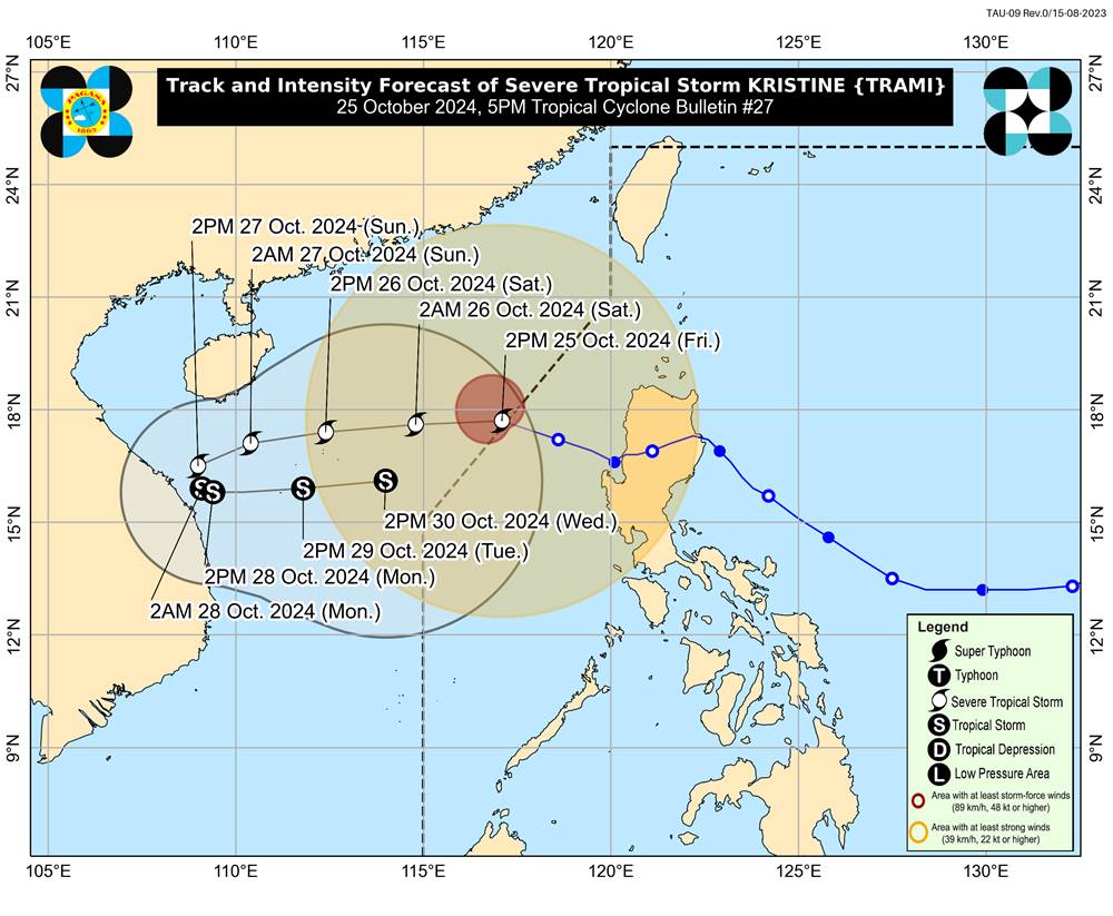
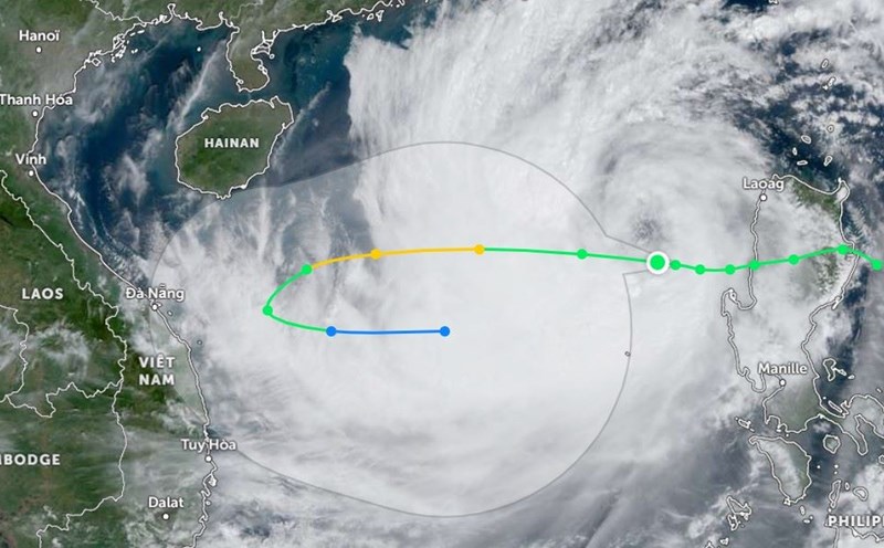
According to the National Center for Hydro-Meteorological Forecasting, as of 4:00 p.m. on October 25, the center of the storm was located at about 17.6 degrees North latitude - 116.6 degrees East longitude, in the eastern sea of the North East Sea, about 450 km east-northeast of the Hoang Sa archipelago. The strongest wind near the center of the storm was level 10 (89-102 km/h), gusting to level 12. The storm moved westward at a speed of about 20 km/h.

Forecast until 4pm on October 26, the storm is moving west at a speed of about 20km/h. The center of the storm is located at about 17.4 degrees North latitude - 112.0 degrees East longitude, in the waters of the Hoang Sa archipelago. The strongest wind near the center of the storm is level 11-12, gusting to level 15. The risk level is level 3 for the North East Sea (including the Hoang Sa archipelago).
At 3:00 p.m. on October 27, the storm moved west-southwest at a speed of about 15km/h. The center of the storm was located at 16.6 degrees north latitude - 108.6 degrees east longitude, in the western area of Hoang Sa archipelago, about 180km northeast of Quang Tri - Quang Ngai.
The strongest wind near the storm center is level 10-11, gusting to level 14. The risk level is level 3 for the North East Sea (including the Hoang Sa archipelago) and the Central Central Coast.
At 4:00 p.m. on October 28, the storm moved southwest, then changed direction to East Southeast, slowing down to 5-10 km/h. The center of the storm was located at about 15.9 degrees North latitude - 109.5 degrees East longitude, in the coastal waters of the Central Central provinces. The strongest wind near the center of the storm was level 9, gusting to level 11. Risk level: level 3 for the west of the North East Sea (including the west of the Hoang Sa archipelago) and the Central Central Coast.
It is forecasted that in the next 72 to 120 hours, the storm will move mainly to the East at 5-10km per hour, and its intensity will continue to weaken.
Under the influence of the storm, from the morning of October 27, on the mainland along the coast from Quang Binh to Quang Ngai, the wind gradually increased to level 6-7, near the storm center level 8-9, gusting to level 11.
From the evening and night of October 26 to October 28, in the area from Quang Tri to Quang Ngai, there will be heavy to very heavy rain with total rainfall ranging from 300-500mm, locally over 700mm.
Warning of the risk of localized heavy rain (over 100mm/3 hours). Ha Tinh - Quang Binh, Binh Dinh and the Northern Central Highlands have heavy rain, some places have very heavy rain with total rainfall from 100-200mm, some places over 300mm.
Given the complex developments of storm No. 6, people in areas predicted to be affected by the storm should not be complacent. Tourists planning to travel to the central coast during this time should pay attention to weather forecasts, check flight schedules, and arrange their time and destination appropriately so as not to affect their journey.


