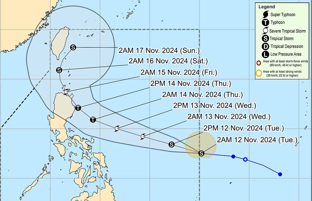
The Philippine Atmospheric, Geophysical and Astronomical Services Administration (PAGASA) reported that Typhoon Usagi entered PAR at 3 a.m. this morning and was last spotted 1,170 km east of Southeast Luzon. Tropical Storm Ofel is moving west-northwest at 25 km/h.
Currently, no strong wind warnings have been issued as the storm has not directly impacted any part of the Philippines.
PAGASA said that based on Usagi's forecast track, the storm will steadily intensify over the next three days and reach typhoon status on Wednesday, November 13.

The storm is also expected to make landfall in Northern Luzon or Central Luzon on Thursday afternoon or evening, November 14.
Relevant authorities, residents and tourists are advised to continue monitoring for more information about Tropical Storm Usagi.
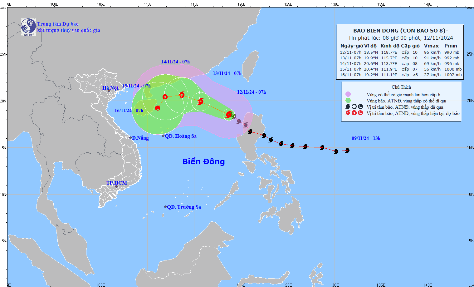
Meanwhile, according to the National Center for Hydro-Meteorological Forecasting, at 7:00 a.m. on November 12, the center of storm No. 8 Toraji was at about 18.5 degrees North latitude; 118.7 degrees East longitude, in the eastern sea of the North East Sea area.
The strongest wind near the storm center is level 9-10 (75-102km/h), gusting to level 12. Moving northwest at a speed of about 10km/h.

It is forecasted that by 7am on November 13, the storm will continue to move northwest at a speed of 15km/h in the eastern sea, in the northern East Sea. The strongest wind near the storm center is level 9-10 (75-102km/h), gusting to level 12.
Forecast until 7am on November 14, the storm is moving in the West Northwest direction at a speed of 10-15km/h, gradually weakening. The strongest wind near the storm center is level 8, gusting to level 10.
From the next 72 to 96 hours, the tropical depression will move in the West Southwest direction, about 5km per hour, and continue to weaken into a tropical depression in the Northwest of the North East Sea area.
Storm No. 7 Yinxing has weakened into a tropical depression, causing prolonged rain in the Central region.

Tourists planning to explore the Central Coast of Vietnam and the Philippines should pay attention to weather forecasts during this time.
The rainy season in the Philippines is from June to October. The ideal time to travel to the Philippines is from November to April, when the temperature is comfortable and there is little rain. However, there is still a risk of typhoons forming late in November and December.
If you plan to travel to the Philippines and areas predicted to be affected by the storm, visitors should proactively monitor announcements from airlines, transport units, and travel companies to proactively plan, build a suitable schedule and ensure safety.


