The US National Hurricane Center (NHC) has just issued an emergency warning of a potential tropical storm forming and potentially seriously affecting the Florida Gulf Coast in the coming days.
At 8:00 a.m. on September 24 (local time), the center of the disturbance system was determined to be at 19.2 degrees North latitude and 83.5 degrees West longitude, about 240 km west of Grand Cayman and about 335 km southeast of the western tip of Cuba.
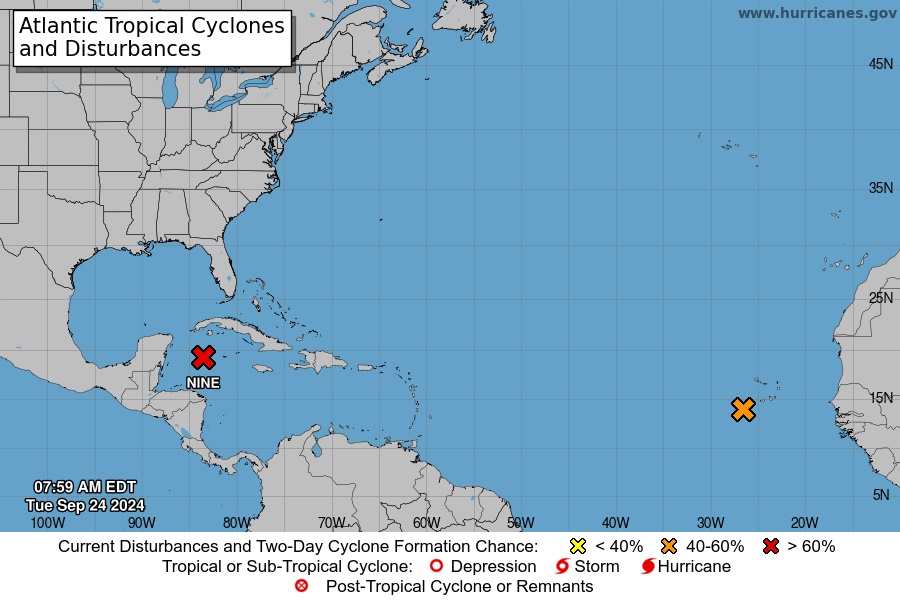
The system is moving northwest at about 15 km/h. It is expected to continue moving in this direction on September 24, then turn rapidly north and northeast in the next 24-48 hours.
Currently, sustained winds are at 55 km/h, but are forecast to strengthen in the coming days. The system is likely to become a hurricane on September 25 and continue to strengthen as it moves across the eastern Gulf of Mexico on September 26.
In the face of complex weather developments, the NHC issued warnings for many areas including from Indian Pass to Flamingo, Florida; Tampa Bay and Port Charlotte, USA.
Tropical storm warnings have also been issued for several other areas, including the Grand Cayman Islands, parts of Mexico and Cuba.
NHC forecasts rainfall of 100-200mm, up to 300mm in some areas, which could cause flash floods and urban flooding.
Rising sea levels, combined with high tides, could see sea levels rise 3-4.5m in some areas. This could cause severe flooding in coastal areas.
Given the complex weather situation, tourists planning to visit the above areas should pay attention to continuously updating weather information from official sources.
If you are planning to travel to affected areas, consider postponing or canceling your trip to ensure your safety and a complete travel experience.
If you are in an affected area and cannot evacuate, strictly follow instructions from local authorities.