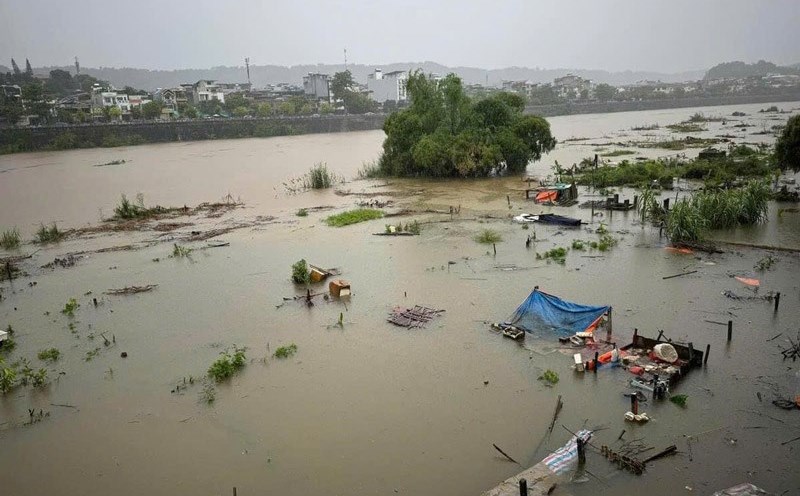
According to the latest information from the National Center for Hydro-Meteorological Forecasting issued at 3:30 p.m. on September 10, the flood on the Thao River in Lao Cai City continues to slowly recede; in Bao Ha, it has peaked at 61.95m (7:00 a.m. on September 10), above alert level 3: 4.95m, 1.02m above the historical flood level in 2008 (60.93m). In Yen Bai, the flood level is fluctuating at the peak of 35.70m, above alert level 3: 3.70m, 1.28m above the historical flood level in 1968 (34.42m) and is receding slowly; in Phu Tho, it is rising rapidly.
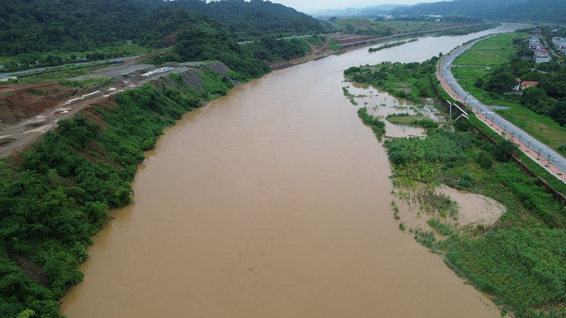
Floods on Lo River (Tuyen Quang, Phu Tho), Cau River (Bac Ninh), Thuong River (Bac Giang), Thai Binh River (Hai Duong), Red River (Hanoi), Hoang Long River (Ninh Binh) are rising; Luc Nam River (Bac Giang) is slowly receding.
Water level at 1:00 p.m. on September 10, on Thao River in Yen Bai was 35.66m, on BĐ3 3.66m, 1.24m above the historical flood level in 1968 (34.42m); in Phu Tho 17.74m, 0.24m above BĐ1.
At the same time, the water level on Cau River at Dap Cau was 6.35m, 0.05m above BĐ3; on Thuong River at Phu Lang Thuong was 6.75m, 0.45m above BĐ3; on Luc Nam River at Luc Nam was 6.29m, 0.01m below BĐ3.
Water level on Lo River in Tuyen Quang is 26.90m, above BĐ3 0.90m; at Vu Quang 19.62m, above BĐ2 0.12m.
On Hoang Long River at Ben De 4.00m, level BĐ3; on Thai Binh River at Pha Lai 5.30m, level BĐ2.
In Hanoi, the water level on the Red River is 9.62m, 0.12m above BĐ1.
It is forecasted that in the next 12 hours, the flood on Thao River in Lao Cai will continue to decrease; in Yen Bai it will decrease slowly but still above the historical flood level; in Phu Tho it will increase to level 2.
Floods on the Lo River in Tuyen Quang are likely to peak at 27.30m, 1.30m above BĐ3 tonight (September 10); in Vu Quang, they will continue to rise and peak at 20.40m, 0.10m below BĐ3, tonight (September 10).
Floods on Cau River continue to rise and are above level 3; Thuong River continues to rise slowly above level 3 - Floods on Luc Nam River slowly fall below level 3. Floods on Thai Binh River continue to rise above level 2. Floods on Hoang Long River continue to rise above level 3.
Floods on the Red River in Hanoi continue to rise rapidly below level 2.
In the next 12-24 hours, the flood on Thao River in Lao Cai will continue to decrease; in Bao Ha it will decrease slowly; in Yen Bai it will continue to decrease but still above the historical flood level; in Phu Tho it will increase above level 2.
Floods on the Lo River will recede slowly. Floods on the Thuong and Cau Rivers will change slowly and remain at level 3. Floods on the Luc Nam River will continue to fall below level 3. Floods on the Thai Binh River will continue to rise to level 3. Floods on the Hoang Long River will change slowly and remain above level 3. Floods on the Red River in Hanoi will rise slowly and remain below level 2.
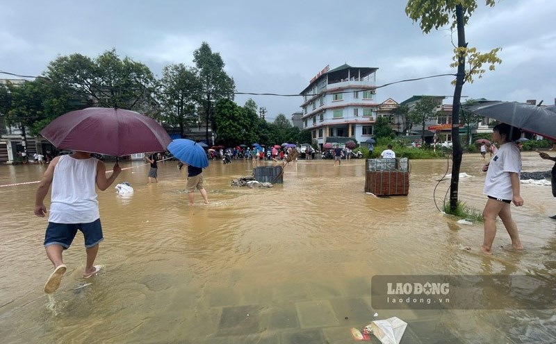
Warning: In the next 12 to 24 hours, the water level at downstream stations of the Red River - Thai Binh River system is likely to rise to level 3 and above. Rising flood water levels cause flooding in low-lying areas along the river, alluvial areas outside the main dike, causing the riverside dikes to overflow, and landslides to seriously affect vulnerable locations in the dike system, embankments, and riverside works in the provinces of: Hanoi, Ha Nam, Nam Dinh, Hai Duong, Hung Yen, Thai Binh, Ninh Binh.
Warning of high risk of flooding in low-lying areas along rivers in the provinces of Lang Son, Cao Bang, Lao Cai, Yen Bai, Phu Tho, Bac Giang, Bac Kan, Thai Nguyen, Hoa Binh. Flash floods and landslides on steep slopes in mountainous areas of the North.
Flood risk warning level: Level 3. Floods on rivers and streams cause flooding in low-lying areas along rivers, river banks are encroached by water, many areas of floating land in the middle of the river are deeply flooded, affecting waterway traffic, aquaculture, agricultural production and socio-economic activities, especially in the lower reaches of the Red River - Thai Binh River.
With warnings of the risk of floods occurring in many places in the Northern region, people and tourists should pay attention to constantly updating weather conditions and comply with local recommendations to ensure safety, especially with schedules to explore coastal areas, rivers, streams...