According to updated information from the National Center for Hydro-Meteorological Forecasting, the flood situation on rivers in the North is currently complicated and can greatly affect the activities of people as well as tourists.
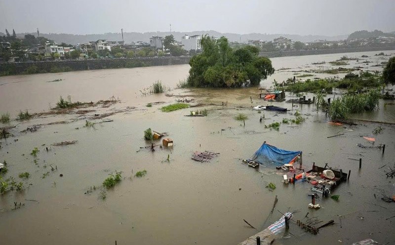
On the Thao River in Lao Cai, the flood level is showing a slow decreasing trend, while in Bao Ha and Yen Bai, the flood is showing an increasing trend. Notably, according to monitoring at 7:00 a.m. on September 10, the water level on the Thao River in Yen Bai reached 35.32m, exceeding the alarm level 3 by 3.32m and 1.1m higher than the historical flood level in 1968 (34.42m).
In Hanoi, the water level of the Red River was recorded at 9.02m, 0.48m lower than the alarm level 1. According to the National Center for Hydro-Meteorological Forecasting, the water level of the Red River in Hanoi is rising rapidly, reaching Alarm level 1 in the next 12 hours; then it may reach Alarm level 2 in the next 24 hours.
Floods are continuing to rise on the Lo River (Tuyen Quang, Phu Tho), Cau River (Thai Nguyen, Bac Ninh), Thuong River (Bac Giang), Thai Binh River (Hai Duong), and Hoang Long River (Ninh Binh). Meanwhile, the water level on the Luc Nam River (Bac Giang) is slowly decreasing.
The National Center for Hydro-Meteorological Forecasting predicts that in the next 12 hours, the flood on the Thao River in Lao Cai will continue to decrease, while the change in Bao Ha will be slow. In Yen Bai, the flood will continue to increase and remain above historical flood levels. The flood level on the Lo River and Cau River will continue to increase, exceeding alert level 3.
In Hanoi, the flood on the Red River is expected to continue to rise rapidly and is likely to reach alert level 1. In the next 12 to 24 hours, the flood on the Thao River in Lao Cai will continue to decrease, while in Bao Ha it will decrease slowly. The flood level in Yen Bai will change slowly but will remain high, exceeding the historical flood level.
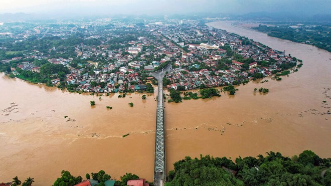
In particular, flooding on the Red River in Hanoi may continue to increase and reach alert level 2.
From now until tomorrow (September 11), rivers in the Northern region are expected to experience a new flood. The flood peak is expected to reach alert level 2 or 3 in small rivers in the Northern mountainous region and the downstream area of the Red River - Thai Binh Delta, with some rivers possibly exceeding alert level 3.
Warning of high risk of flooding in low-lying areas along rivers in the provinces of Lang Son, Cao Bang, Lao Cai, Yen Bai, Phu Tho, Bac Giang, Bac Kan, Thai Nguyen and Hoa Binh. Special attention should also be paid to the risk of flash floods and landslides on hillsides in the mountainous areas of the North.
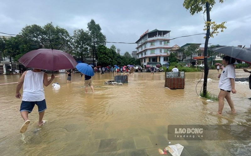
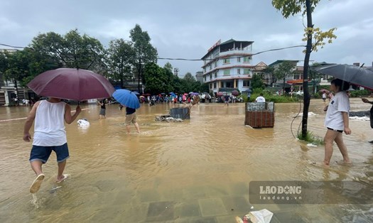
Given the complex flood situation, residents and tourists need to update information from authorities and weather forecasts before planning to travel to high-risk areas.
Avoid low-lying areas, flats or riverside areas at risk of flooding.
If you are in a flood-prone area and cannot move to safety, follow the signs and instructions of local authorities, contact local authorities or rescue organizations for timely support and guidance.