The National Center for Hydro-Meteorological Forecasting issues an emergency bulletin on the severe flooding situation occurring in the northern provinces of Vietnam.
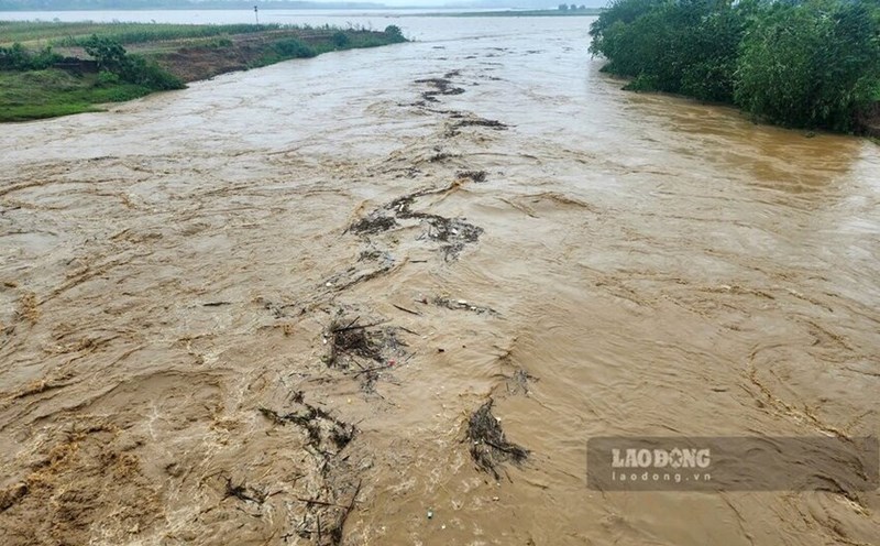
According to the report, exceptionally large floods are occurring on the Thao River, with the water level in Yen Bai reaching 34.51m, 2.51m higher than the alarm level 3 and 0.09m higher than the historical flood level in 1968.
At the same time, emergency flooding was also recorded on Lo River, Cau River, Thuong River and Hoang Long River.
Specifically, the water level on the Cau River at Dap Cau is at 7.20m, 0.90m above BD3; on the Thuong River at Phu Lang Thuong is at 7.09m, 0.79m above BD3; on the Lo River at Tuyen Quang is at 27.72m, 1.72m above BD3; at Vu Quang is at 21.01m, 0.51m above BD3; on the Hoang Long River at Ben De is at 4.47m, 0.47m above BD3.
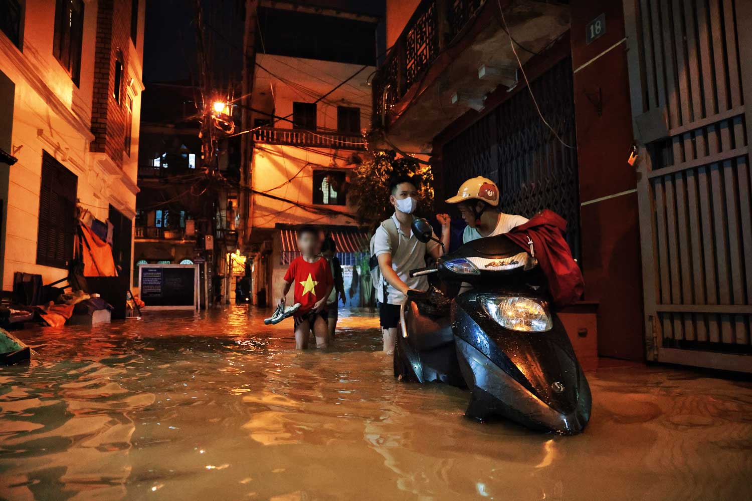
In Hanoi, the water level of the Red River has reached 10.86m, 0.36m higher than the 2nd level.
It is forecasted that in the next 12 hours, the flood on the Red River in the capital is likely to peak at noon on September 11, at level above BD2 and below BD3.
Floods on Cau River continue to rise and remain above level 3; floods on Thuong River and Hoang Long River will change slowly and remain above level 3.
Flood on Thai Binh River continues to rise to level 3.
In the next 12 to 24 hours, flood on Thao River in Yen Bai will continue to decrease to level 2; in Phu Tho to level 1.
Floods on the Lo River in Tuyen Quang and Vu Quang will drop to level 2, floods on the Cau River in Dap Cau will change slowly above level 2.
Floods on the Thuong River will change slowly above level 3; floods on the Thai Binh River will change slowly above level 3; floods on the Hoang Long River will decrease slowly at level 3 and floods on the Red River in Hanoi will decrease slowly and below level 2.
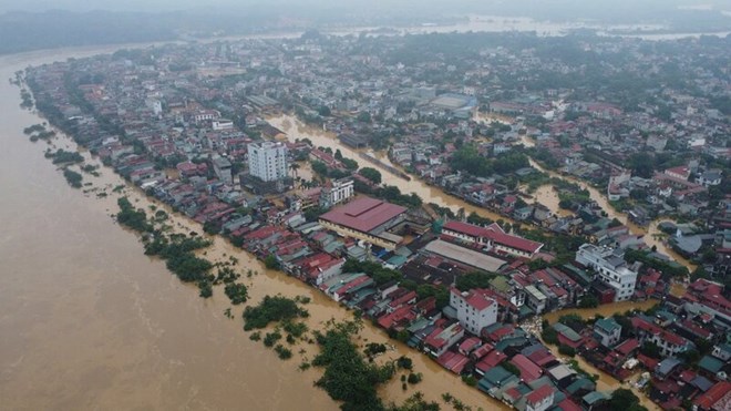
The National Centre for Hydro-Meteorological Forecasting also warned of a high risk of flooding in low-lying areas along rivers in the provinces of Lang Son, Cao Bang, Lao Cai, Yen Bai, Phu Tho, Bac Giang, Bac Kan, Thai Nguyen and Hoa Binh.
In addition, the northern mountainous region also faces the risk of flash floods and landslides on steep slopes.
This situation can lead to the collapse of riverbank dykes, landslides of dykes, seriously affecting key locations in the dyke system, embankments and riverside works in the provinces of Hanoi, Ha Nam, Nam Dinh, Hai Duong, Hung Yen, Thai Binh and Ninh Binh.
The flood disaster risk level is determined at level 3. The Centre forecasts that floods will affect waterway traffic, aquaculture, agricultural production and people's lives, especially in the downstream area of the Red River - Thai Binh river system.
Residents and tourists in affected areas need to closely monitor weather developments and proactively take flood prevention measures to minimize possible damage.