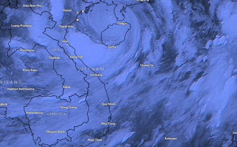
According to the National Center for Hydro-Meteorological Forecasting, at 7:00 a.m. on September 7, the center of storm No. 3 was located at about 20.4 degrees North latitude; 108.2 degrees East longitude, in the Gulf of Tonkin; about 150km East Southeast of Quang Ninh - Thai Binh. The strongest wind near the center of the storm was level 14 (150-166km/h), gusting to level 17, moving in the West Northwest direction, speed 15-20km/h.
Due to the influence of storm No. 3, Bach Long Vi Island has strong winds of level 12, gusting to level 14. Co To Island has strong winds of level 7, gusting to level 11. Mong Cai (Quang Ninh) has strong winds of level 6, gusting to level 9. Cua Ong (Quang Ninh) has strong winds of level 8, gusting to level 9.
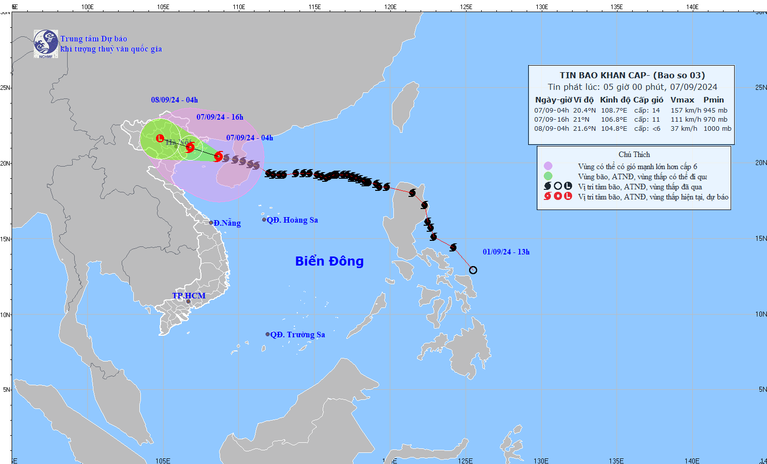
It is estimated that in the next 12 hours, by 7:00 p.m. on September 7, the storm will make landfall in the Northeast in a West-Northwest direction, at a speed of 15-20 km/h. Winds will be at level 9-10, gusting to level 12. Dangerous areas include: North of latitude 18.5N, West of longitude 110.0E.
Level 4 disaster risk areas include: the Northern Gulf of Tonkin, coastal waters and mainland of Quang Ninh, Hai Phong, Thai Binh; level 3 includes: the Southern Gulf of Tonkin, coastal waters and mainland of Thai Binh, Nam Dinh, Ninh Binh and Thanh Hoa.
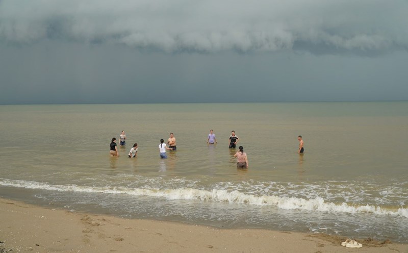
People and tourists in the Gulf of Tonkin and coastal provinces in the North should pay attention to weather conditions, proactively prepare safe storm avoidance plans, and follow the instructions and recommendations of local authorities.
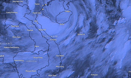
It is forecasted that by 7am on September 8, Typhoon Yagi will continue to move in a West-Northwest direction deep inland at a speed of 15-20km/h, weakening and gradually dissipating. The storm is located in the provinces of Viet Bac and Bac Bo.
At this time, the wind intensity has decreased to below level 6. The dangerous areas include the North of latitude 19.5N; the West of longitude 110E. The level 3 natural disaster risk areas are: Bac Bo Gulf, coastal waters and mainland of Quang Ninh, Thanh Hoa, Thai Binh, Nam Dinh, Ninh Binh and Than Hoa provinces.
On the morning of September 7, the sea area of Bac Bo Gulf (including Bach Long Vy and Co To island districts) had strong winds of level 9-11, near the eye of the storm level 12-14, gusting to level 17; the sea was very rough. Waves were 3.0-5.0m high, near the eye of the storm 6.0-8.0m high.
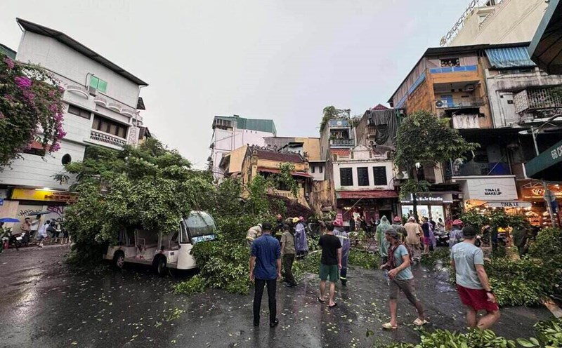
Coastal areas from Quang Ninh to Thanh Hoa have strong winds of level 6-7, then increasing to level 8-9, areas near the storm center have levels 10-12, gusting to level 14; areas deep inland in the Northeast have strong winds of level 6-8, gusting to level 9-11 (the strongest wind time is from morning to evening on September 7). Waves are 2.0-4.0m high.
Coastal areas from Thanh Hoa to Quang Ninh need to be on guard against storm surges of 0.5m (Thanh Hoa) to 2.0m (Quang Ninh) in the afternoon and night of September 7. Coastal areas from Quang Ninh to Hai Phong need to be on guard against water receding by about 0.5m in the morning and noon of September 7.
From September 7 to the morning of September 9, in the Northern region and Thanh Hoa, there was a widespread heavy rain with total rainfall ranging from 100-350mm, in some places over 500mm.
The heaviest rain in the Northeast will be concentrated during the day and night of September 7; in the Northwest from the evening of September 7 to the night of September 8.
Heavy rains can cause flooding in low-lying areas; flash floods in small rivers and streams, and landslides on steep slopes.
Due to the influence of the wide storm circulation, in the Northwest region, the area from Nghe An to Thua Thien Hue needs to be on guard against the risk of thunderstorms, tornadoes, and strong gusts of wind.