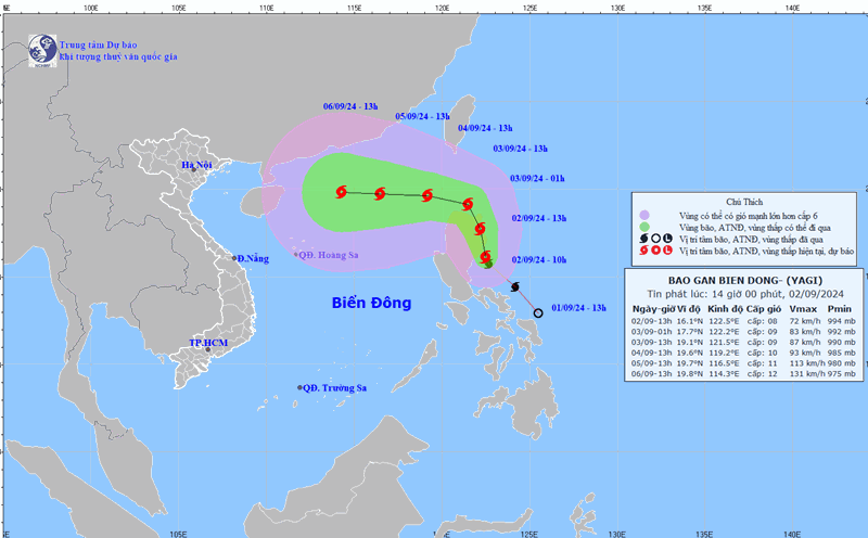
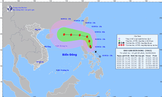
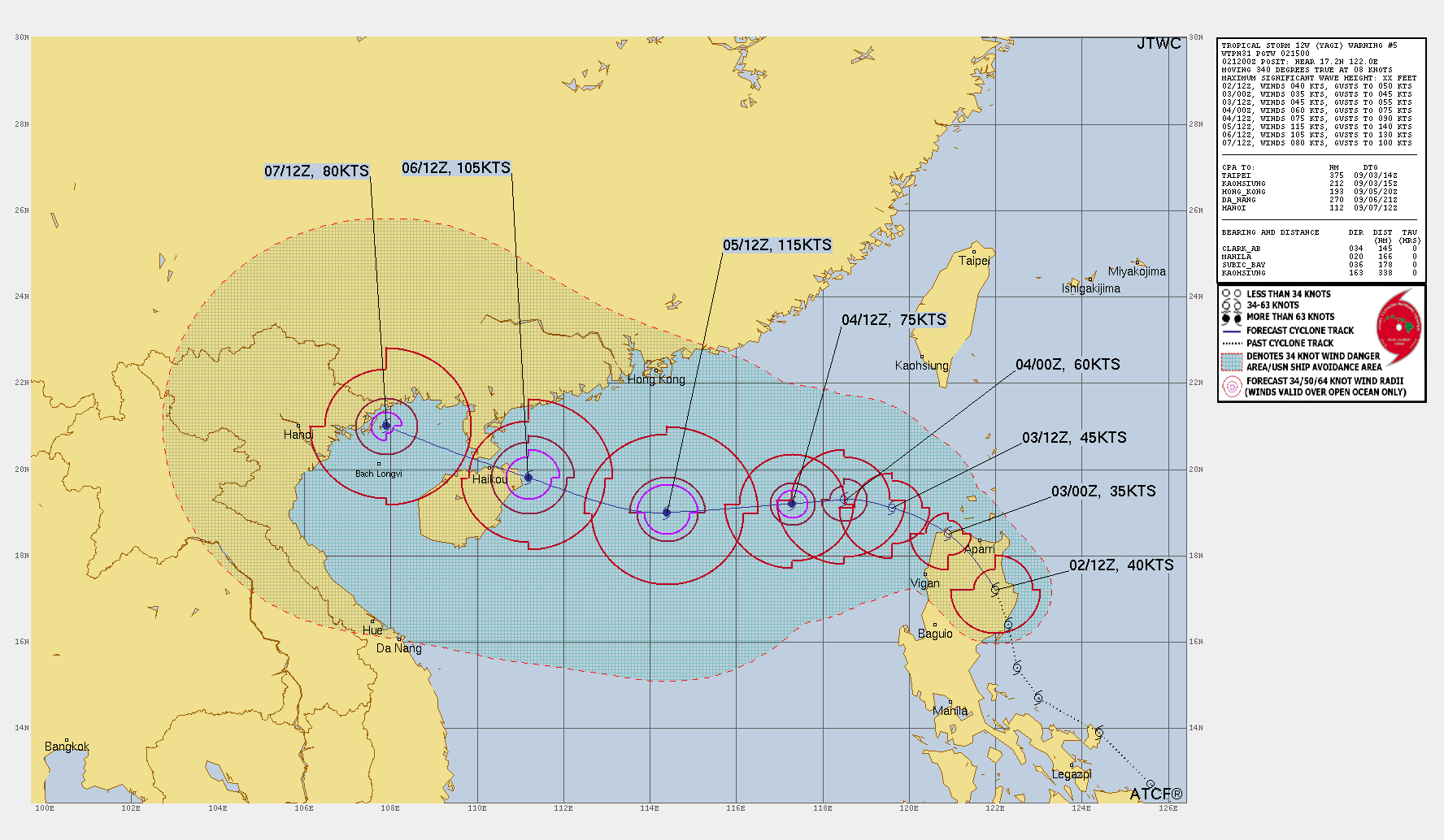
According to the latest storm warning information from the Joint Typhoon Warning Center (JTWC) of the US Air Force and Navy, Tropical Storm Yagi is moving northwest and is expected to strengthen into a typhoon in the coming days.
At 7:00 p.m. on September 2 (Vietnam time), the center of the storm was located at approximately 17.2 degrees North latitude; 122.0 degrees East longitude, approximately 308 km northeast of Manila (Philippines). The strongest wind near the center of the storm was level 8 (75 km/h), gusting to level 9-10.
It is forecasted that in the next 24 hours, the storm will move northwest at a speed of about 13 km/hour and is likely to strengthen.
At 7:00 p.m. on September 3, the center of the storm was at approximately 19.1 degrees North latitude; 119.6 degrees East longitude. The strongest wind near the center of the storm was level 9 (75-90 km/h), gusting to level 10-11.
During the next 48 to 72 hours, the storm will continue to move west at a speed of 11-13 km/h and rapidly intensify.
It is forecasted that by 7:00 p.m. on September 5, the storm's intensity may reach level 12 (115 km/h), with gusts of level 14-15.
Notably, JTWC meteorological experts warned that Typhoon Yagi is likely to directly impact the northern part of the East Sea in the coming days. Coastal provinces in the north and central regions of Vietnam need to closely monitor the storm's developments and prepare response plans.
People and vessels operating at sea need to regularly update information about storms and strictly follow recommendations from authorities to ensure safety.
Localities need to proactively implement measures to prevent and limit damage caused by storms.
JTWC will continue to update information about this storm in the following bulletins at 4:00, 10:00, 16:00 and 22:00 daily (Vietnam time).