According to the latest information from the Hong Kong Meteorological Department (China), a tropical storm forming near the Philippines is expected to move into the East Sea in the coming days.
Specifically, the tropical depression near the East Sea is likely to strengthen into a storm within the next 12 hours and is expected to move towards Luzon, Philippines before approaching the northern area of the East Sea.
The storm is forecast to affect the southern coast of China this week, with the weather forecast to change markedly over the weekend.
According to the Hong Kong Meteorological Department's (China) storm forecast on September 1, from September 5 to 9, Hong Kong (China) is likely to have rain, although the temperature here will remain at around 32 degrees Celsius.
Previously, the agency also warned that there could be 3 to 5 more storms entering the area within 500 km of Hong Kong (China) this year.
In the first seven months of 2024, the northwest Pacific and South China Sea recorded only five storms, much lower than the long-term average of 10 storms during this stage of the season.
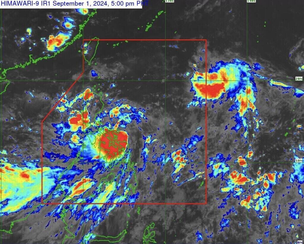
In the Philippines, the Philippine Atmospheric, Geophysical and Astronomical Services Administration (PAGASA) announced that at 3:00 p.m. on September 1, the center of tropical depression Enteng was about 105 km northeast of Catarman, Northern Samar, or about 155 km east of Juban, Sorsogon.
This tropical depression has maximum sustained winds of 55 km/h and gusts of up to 70 km/h, and is moving northwest at 15 km/h.
In its 5 p.m. update on September 1, PAGASA said tropical depression Enteng is intensifying over the northeastern waters of Northern Samar.
Enteng is forecast to move mainly northwest until early morning on September 2 and may make landfall in the vicinity of Catanduanes or Albay within the next 12 hours.
On September 2, Enteng will turn north-northwest or north, moving across the sea east of Luzon.
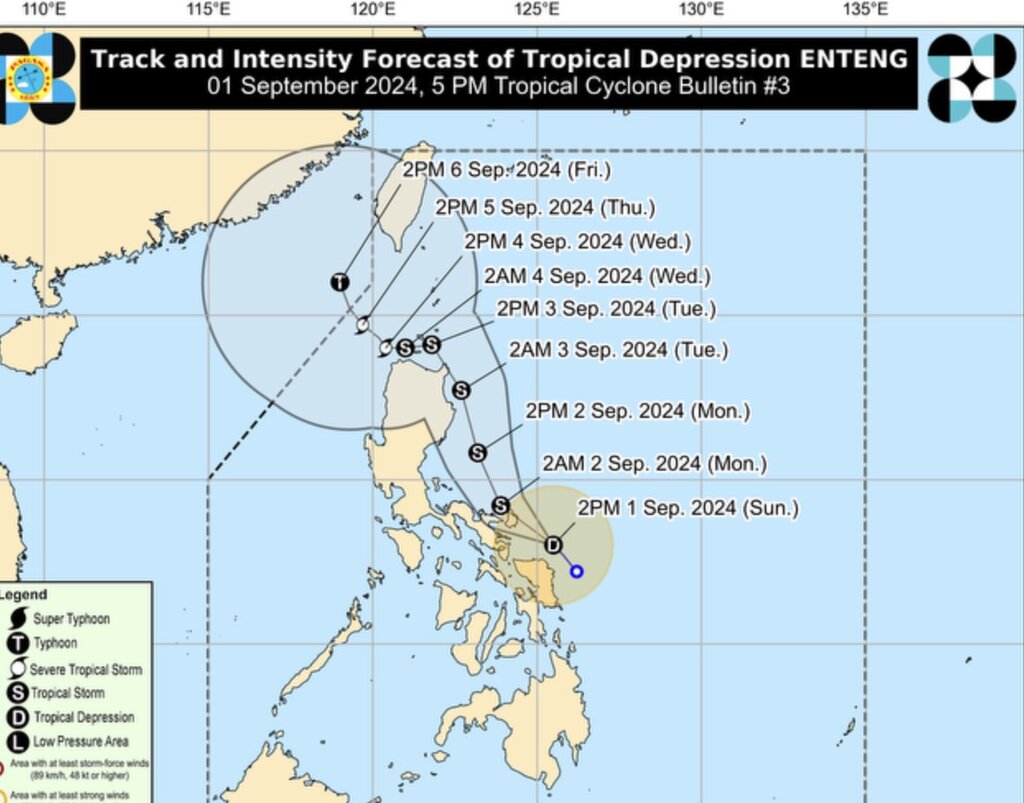
Enteng is forecast to continue moving northwest from September 3 to 4 and may pass through the Luzon Strait. Forecasters do not rule out the possibility that Enteng could make landfall in northern Luzon or the Babuyan Islands.
From September 5 onwards, Enteng is forecast to move more northwestward. Also according to information from PAGASA, Enteng is likely to strengthen into a typhoon within the next 12 hours and maintain tropical storm intensity until the morning of September 4.
This storm No. 5 is likely to reach its strongest intensity on September 5 or 6.
It is forecasted that at 2:00 p.m. on September 5, Typhoon Enteng will be about 190 km west-northwest of Calayan, Cagayan, Philippines, and by September 6, the storm will be about 295 km west of Itbayat, Batanes, leaving the forecast area of the Philippines.
Given the above weather conditions, visitors should closely monitor weather reports and warnings from meteorological agencies before planning to travel or visit areas expected to be affected.
In particular, coastal areas and islands in the Philippines, Hong Kong (China), and surrounding areas should be prepared for possible severe weather conditions. Always be prepared to follow safety instructions and adjust your travel plans according to weather developments to ensure the safety of yourself and your family.