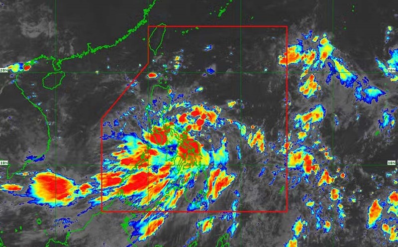
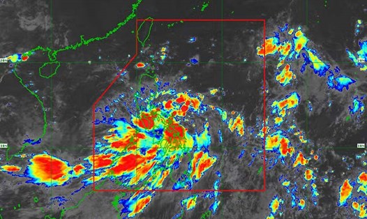
According to the latest announcement on September 2 from the National Center for Hydro-Meteorological Forecasting, a storm with the international name Yagi is active in the sea east of Luzon Island (Philippines).
At 1 p.m., the center of the storm was at approximately 16.1 degrees North latitude; 122.5 degrees East longitude, in the sea east of Luzon Island. The strongest wind near the center of the storm was 8 (62-74 km/h), gusting to level 11, moving in a North-Northwest direction, at approximately 20 km/h.
It is forecasted that when this storm enters the East Sea, it will encounter favorable conditions such as warm sea surface, weak wind shear, and the storm can strengthen very quickly. From September 4-6, the storm will continuously increase in strength, possibly reaching level 12, gusting to level 15.
In the next 72 hours, the storm will move in a West-Northwest direction at a speed of about 20km/h. It is forecasted that around the night of September 3, storm Yagi will enter the East Sea. From the afternoon of September 3, the northeastern sea area of the North East Sea will gradually increase in wind speed to level 6, near the center of the storm will increase in wind speed to level 8, gusting over level 11; rough seas.
At 1 p.m. on September 4, the storm will turn west and slow down to 10 km/h, moving into the East Sea. On September 5, the storm will continue moving west at a speed of 15 km/h.
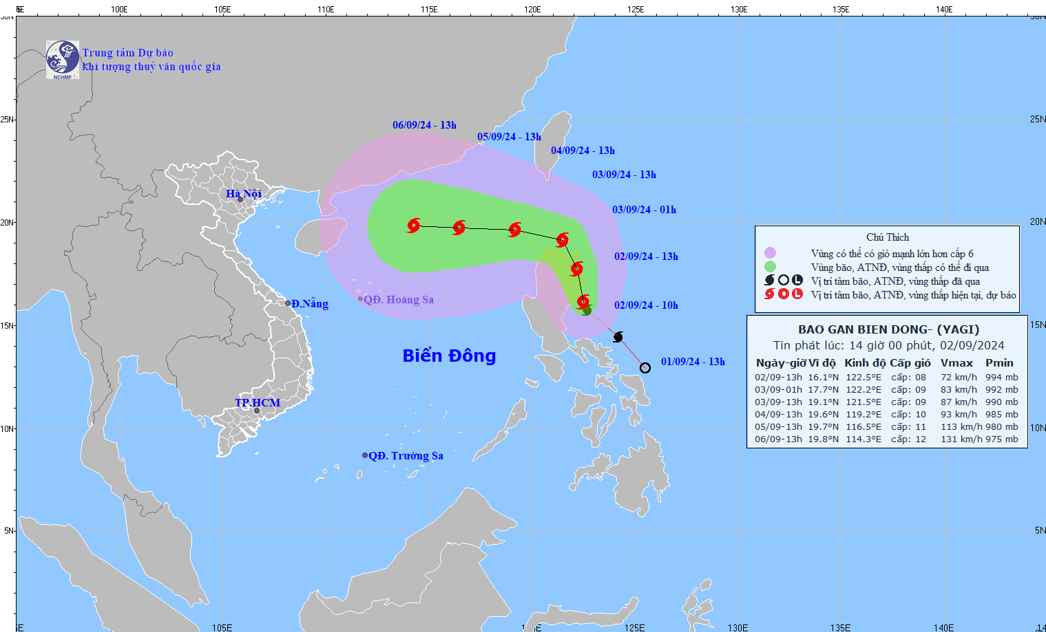
It is forecasted that from September 4-6, storm Yagi may reach very strong storm level in the Northeast of the East Sea, with maximum strong winds reaching level 12, gusting to level 15 near the storm's center.
From the next 72 to 120 hours, the storm will move mainly in a westerly direction, traveling 10-15km per hour, with the potential to strengthen and cause significant impacts.
According to the meteorological agency's warning, in the next 24 hours, the eastern sea of the North East Sea area, the waves will be 2 to 4 meters high. Then from 4-6.9 it can increase to 5-7 meters, the sea will be rough, very dangerous for ships.
With this information, people and tourists need to pay attention to weather forecast updates, proactively take storm prevention measures and consider beach trips in the North and Central regions this week.