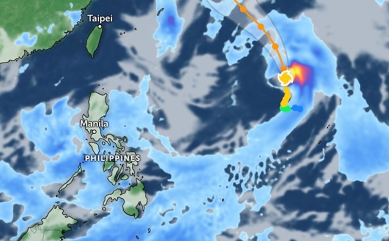
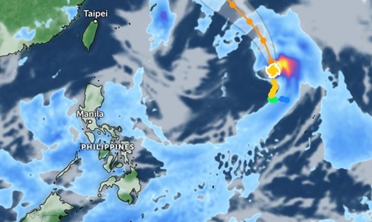
The Philippine Atmospheric, Geophysical and Astronomical Services Agency (PAGASA) issued a warning about tropical storm/low pressure activity in the upcoming September.
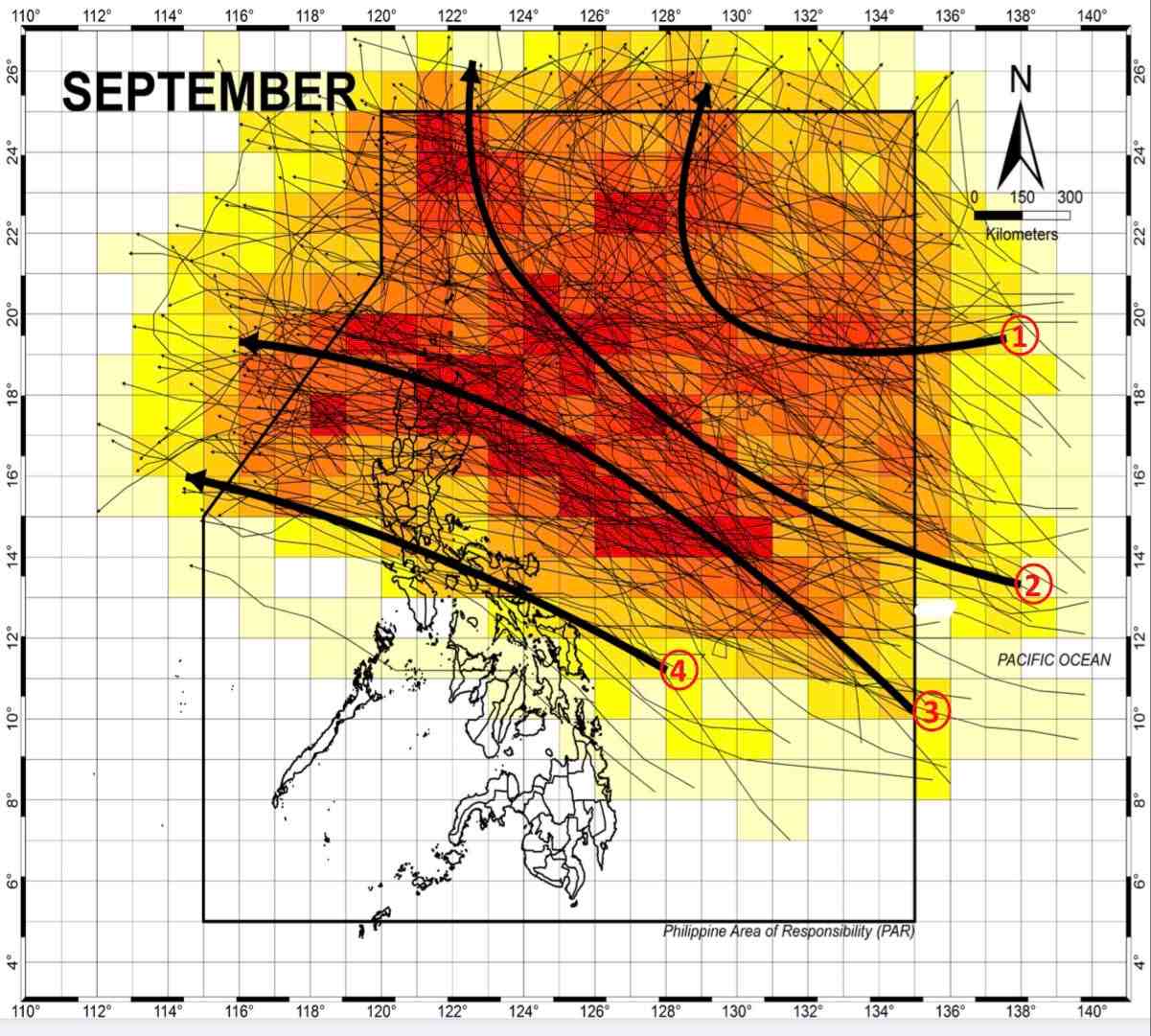
According to the forecast map, storms tend to move along 4 main paths. From September 2-8, PAGASA forecasts that a new low pressure will form in the Northeast of the Philippines and is likely to develop into a tropical storm.
The storm's path is toward the Northeast, affecting Japan and South Korea. Some storms move northwest, toward Taiwan (China).
More dangerously, many storms will land directly in the Philippines, then enter the East Sea and move towards Vietnam. Specifically, the storm could sweep across the North and the Northern tip of Luzon Island and then head straight into Hong Kong (China) or Vietnam.
Another direction of the storm could land in the southern part of Luzon island and move straight into Vietnam. With strong intensity, storms have the ability to cause heavy rain, strong winds, high waves, and even tornadoes, seriously threatening the lives and property of people and tourists in coastal areas. .
According to the National Center for Hydrometeorological Forecasting, in September, there is a possibility of about 5-7 storms/tropical depressions appearing in the East Sea; Of which, about 2-3 storms landed on land.
The average number of storms/tropical depressions in many years in the East Sea during this period is from 6 to 7, with an average of about 3 storms landing in Vietnam.
The meteorological agency especially noted that in the upcoming period of the 2024 storm season, it is necessary to guard against the possibility of tropical storms/low pressure forming right in the East Sea area. Across the country, there continues to be the possibility of dangerous weather phenomena such as thunderstorms, tornadoes, lightning and strong winds.
Therefore, tourists need to constantly update weather forecast information and avoid traveling to islands during the peak months of storm season. Prepare necessary luggage and follow local government instructions to ensure trip safety.