In the afternoon of May 5, in many central areas of Ho Chi Minh City, thunderstorms developed and caused rain in Dien Hong, Vuon Lai, Xuan Hoa wards...
Real-world records show that the rain appeared quite unexpectedly during rush hour, making many people unable to react in time. On the roads, motorcyclists rushed to find shelter, and some areas experienced localized congestion due to increased traffic in rainy conditions.
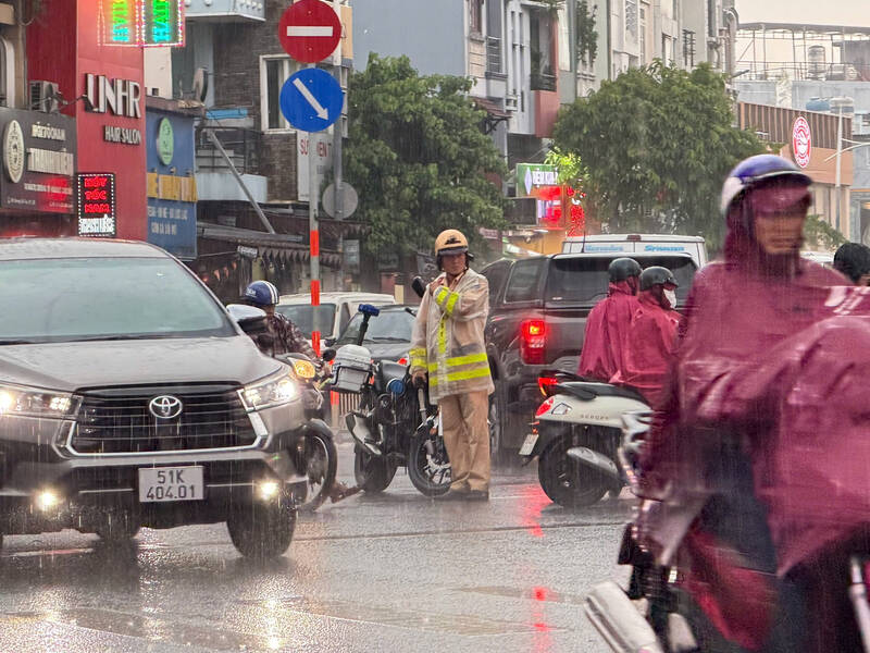
The sudden rain made me have to pull over to the porch and wait for it to stop before I could continue driving. In recent days, it's been hot, so rain makes the weather more pleasant" - Mr. Nguyen Triet, a technology driver, said.
According to the Southern Hydrometeorological Station, due to the influence of the development of the western low pressure combined with wind disturbances at high altitude, the area of Ho Chi Minh City and its vicinity is experiencing widespread thunderstorms.
According to data from satellite cloud images, weather radar and lightning positioning systems, convection cloud areas are developing strongly, causing showers with thunderstorms and lightning in many areas such as Binh Tien, Chanh Hung, Phu Dinh, Long Binh, Long Phuoc, Long Truong, Cat Lai, Binh Trung, Tan Dong Hiep, An Phu, Thu Dau Mot, Phu Loi, Chanh Hiep, Hoa Loi... and many communes in Binh Chanh, Cu Chi, Tan Uyen, Bac Tan Uyen, Phu Giao.
Radar response intensity in some places reached a high level, indicating that thunderstorms could occur with strong intensity in a short time.
Forecast for the next 3 hours, convective clouds will continue to develop and expand, causing showers with thunderstorms and lightning in many areas, then spreading to neighboring areas. Common rainfall is from 12-60 mm, in some places over 80 mm.
During thunderstorms, people need to be wary of dangerous phenomena such as tornadoes, lightning, strong gusts of wind at level 5-7 (8-17 m/s) and the risk of localized flooding in low-lying areas.