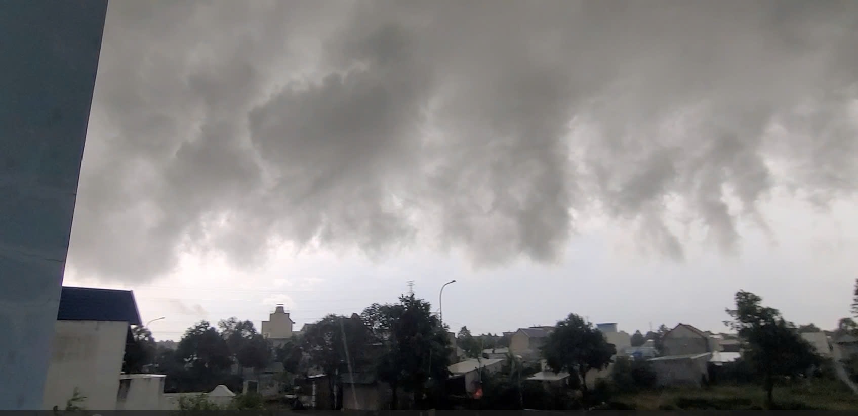
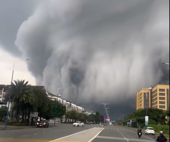
Initial information, at around 5pm on August 31, thick, rolling clouds like a "tsunami" invaded the sky of Binh Duong. The large, opaque white cloud, about 3 layers high, moved as if it wanted to swallow the entire sky. The moving cloud covered the sky and swooped down low near people's houses.
This cloud appeared in Thu Dau Mot, Thuan An, Tan Uyen and Ben Cat cities. The image of the strangely shaped moving cloud made people scared. Many people filmed and took pictures of these images and posted them online.
According to hydrometeorological experts , this phenomenon is completely normal and not dangerous.
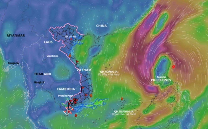
Currently, there is a low trough in the East Sea and the southwest wind is strong, so convective clouds develop rapidly, forming unique structures.

According to records, this phenomenon not only occurred in Binh Duong, but also occurred in some places in Ho Chi Minh City on August 31. The Southeast Hydrometeorological Station issued a warning about thunderstorms and heavy rain in Ho Chi Minh City and neighboring areas. A thunderstorm area developed in Ho Chi Minh City and spread to surrounding areas.
The Southeast Hydrometeorological Station warns that in the evening of August 31, there will continue to be thunderstorms, showers, and gusts of wind of level 5-7 in Ho Chi Minh City and neighboring areas. Beware of the risk of flooding in areas with poor drainage.