According to storm news, the latest low pressure from the Joint Typhoon Warning Center (JTWC), two low pressures are continuing to operate in the western Pacific Ocean.
In which, the low pressure bearing the symbol Invest 99W suddenly changed direction from West to South, towards the southern area of Guam Island in the Western Pacific.
The strongest wind near the center of the low pressure reached 30 km/h. The low pressure is forecast to have little chance of strengthening into a tropical depression or storm in the next 24 hours.
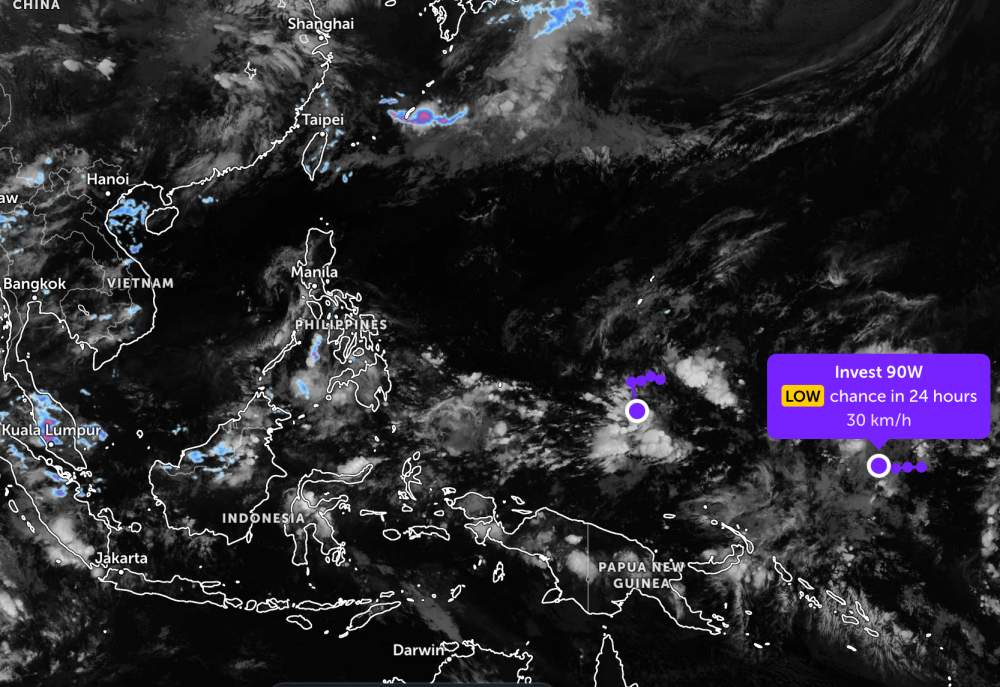
The remaining low pressure bearing the symbol Invest 90W is also moving in the West direction, in the western Pacific Ocean. The strongest wind near the center of the low pressure reaches 30 km/h.
JTWC forecasts that this low pressure is also unlikely to strengthen into a tropical depression in the next 24 hours.
Depression Invest 99W causes heavy thunderstorms on Guam Island (USA) from now until May 26. The highest humidity reaches 82% with maximum wind speed 27 km/h. After May 26, the rain will gradually decrease but still drizzle until the end of next week.
According to the National Center for Hydro-Meteorological Forecasting, in the sea areas of our country, there are common showers and thunderstorms in some places, visibility over 10km. The area north of the Gulf of Tonkin has south to southwest winds of level 5, sometimes level 6, gusts of level 7, rough seas, waves 1.5 - 2.5m high.
The area south of the Gulf of Tonkin and the area from South Quang Tri to Khanh Hoa will have winds of level 4-5, waves 1.0 - 2.0m high. The sea area from Lam Dong to An Giang, the Gulf of Thailand and the area from Ca Mau to An Giang will have scattered showers, with thunderstorms in some places, with the risk of tornadoes and strong gusts in thunderstorms.
The sea areas of Hoang Sa, Truong Sa, North, Central and South East Sea will have light winds of level 4, waves commonly from 0.5 - 2.0m high.
People and tourists planning to go to Guam or these sea areas should pay attention to weather forecasts. Avoid going out to sea when the sea is rough and follow local instructions to ensure safety throughout the journey.