According to storm news, the latest low pressure from the Joint Typhoon Warning Center (JTWC), the low pressure bearing the symbol Invest 98W is continuing to operate strongly in the Pacific Ocean.
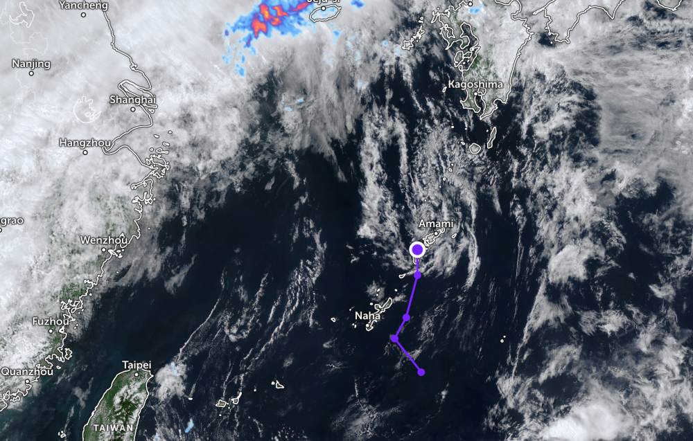
As of the night of May 19, the low pressure has officially made landfall on an island in the Okinawa archipelago of Japan. After that, the low pressure continued to move north, through this island.
Due to contact with the ground surface, the strongest wind near the center of the low pressure has decreased to 35 km/h. The low pressure is forecast to have little chance of strengthening into a tropical depression or storm in the next 24 hours.
The low pressure did not cause rain on the islands of the Okinawa archipelago of Japan on May 20. However, from May 21-22, it will be cloudy, with showers and thunderstorms in many places. Air humidity reaches 40-63%.
In the East Sea, according to the National Center for Hydro-Meteorological Forecasting, on the morning of May 20, the area of the Northern Gulf of Tonkin, the sea area from Lam Dong to Ca Mau, Ca Mau to An Giang had scattered showers and thunderstorms.
Forecast for the day and night of May 20, the Gulf of Tonkin area, the sea area from Lam Dong to Ca Mau, Ca Mau to An Giang and the Gulf of Thailand will have scattered showers and thunderstorms. In thunderstorms, there is a possibility of tornadoes, strong gusts of wind at level 6-7 and sea waves over 2.0m high.
All ships operating in the above areas are at risk of being affected by tornadoes, strong gusts of wind and high sea waves.
People and tourists planning to go to these sea areas or areas with low pressure should pay attention to weather forecasts. Do not go out to sea when the sea is rough and follow local instructions to avoid rain, wind, and big waves at sea affecting the journey.


