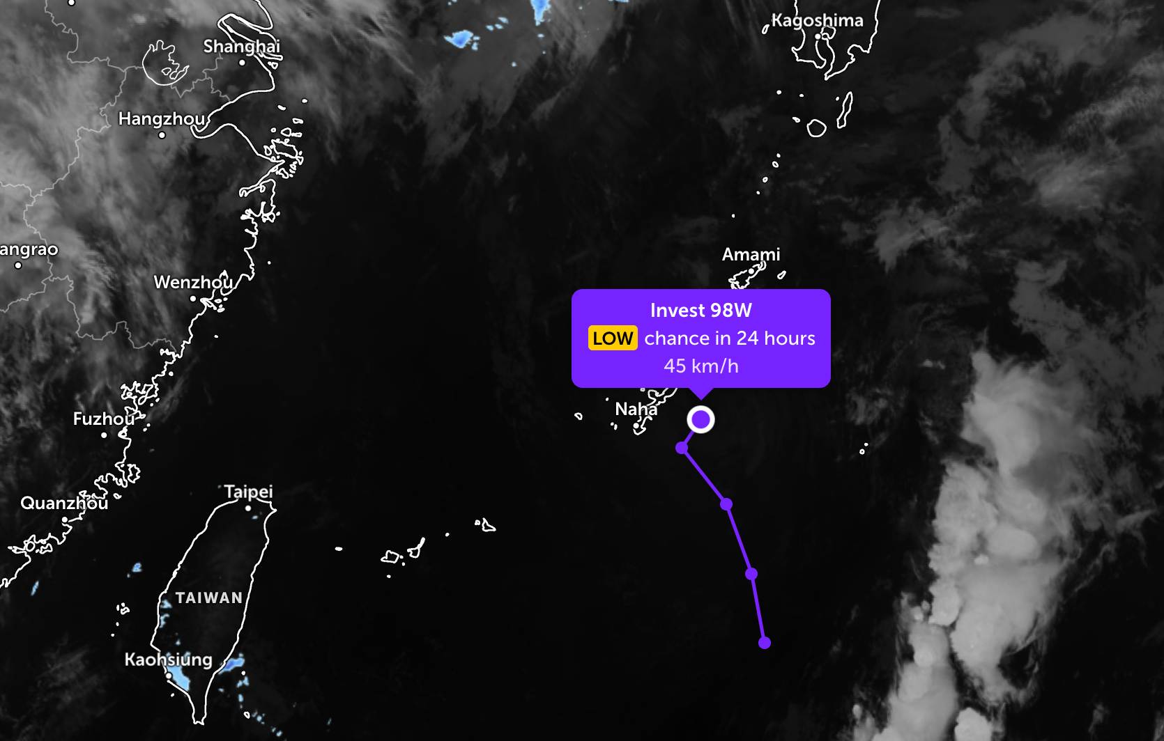
According to storm news, the latest low pressure from the Joint Typhoon Warning Center (JTWC), the low pressure bearing the symbol Invest 98W is strengthening near the East Sea.
As of the evening of May 19, the center of the low pressure was located near the Okinawa archipelago of Japan. In the past 6 hours, the low pressure moved quickly in the North - Northwest direction, then suddenly changed direction to the Northeast.
The strongest wind near the center of the low pressure has increased to 45 km/h. However, this low pressure is forecast to have little chance of strengthening into a tropical depression or storm in the next 24 hours.
Due to the influence of the low pressure, from now until May 22, the Okinawa archipelago area of Japan will have showers and thunderstorms in some places. The highest humidity reaches 40-63%.
Meanwhile, in the waters of Vietnam, it is forecasted that on the night of May 19 and the day of May 20, the Gulf of Tonkin area, the western sea area of the Northern East Sea (including the Hoang Sa special zone), the sea area from Lam Dong to Ca Mau, Ca Mau to An Giang and the Gulf of Thailand will have showers and scattered thunderstorms. In thunderstorms, there is a possibility of tornadoes, strong gusts of wind at level 6-7 and sea waves over 2.0m high.
All ships operating in the above areas are at risk of being affected by tornadoes, strong gusts of wind and high sea waves.
People and tourists planning to go to these sea areas or areas with low pressure should pay attention to weather forecasts. Do not go out to sea when the sea is rough and follow local instructions to avoid rain, wind, and big waves at sea affecting the journey.


