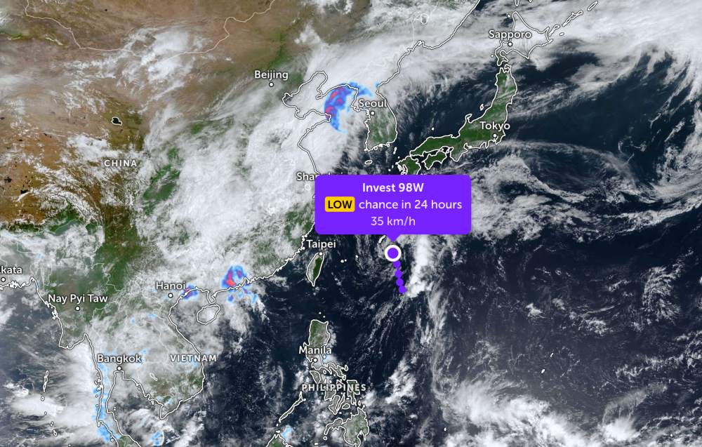
According to storm news, the latest low pressure of the Joint Typhoon Warning Center (JTWC), the low pressure bearing the symbol Invest 98W is operating in the Pacific Ocean.
By the morning of May 19, the center of the low pressure area is currently located near the Okinawa archipelago of Japan. The low pressure area is moving in the North - Northeast direction, towards the Amami and Naha archipelagos of Japan.
The strongest wind near the center of the low pressure reached 35 km/h. The low pressure is forecast to have little chance of developing strongly into a tropical depression or storm in the next 24 hours.
Because it is still quite far from the mainland, the low pressure only causes thunderstorms and big waves at sea, not affecting the surrounding archipelagos much.
In the East Sea, according to the National Center for Hydro-Meteorological Forecasting, on May 19, the area of the Northern Gulf of Tonkin, the western sea area of the North East Sea (including the Hoang Sa special zone), the sea area from Lam Dong to Ca Mau, Ca Mau to An Giang and the Gulf of Thailand will have showers and scattered thunderstorms. In thunderstorms, there is a possibility of tornadoes, strong gusts of wind at level 6-7 and sea waves over 2.0m high.
All ships operating in the above areas are at risk of being affected by tornadoes, strong gusts of wind and high sea waves.
People and tourists planning to visit these sea areas should pay attention to weather forecasts. Follow local instructions and avoid going to sea when the sea is rough to ensure safety.


