Low pressure activity in the Indian Ocean, strong thunderstorms in the East Sea

Chí Long |

A low pressure area is operating in the Indian Ocean, while the East Sea has thunderstorms and strong gusts of wind.

According to storm news, the latest low pressure from the Joint Typhoon Warning Center (JTWC), a low pressure area is operating in the Indian Ocean.

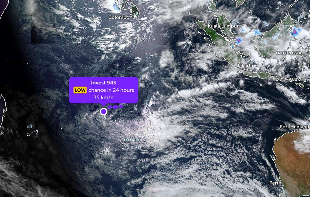
As of this morning, May 17, the location of the low pressure center with the symbol Invest 94S is currently located in the Southwest Indian Ocean. The strongest wind near the low pressure center reaches 35 km/h.

JTWC forecasts that the low pressure is unlikely to strengthen into a tropical depression or storm in the next 24 hours.

Cập nhật vị trí của áp thấp trên Ấn Độ Dương. Ảnh: JTWC
Update on the position of the low pressure on the Indian Ocean. Photo: JTWC

Meanwhile, in the East Sea, according to the National Center for Hydro-Meteorological Forecasting, the Gulf of Tonkin area, the western sea area of the Northern East Sea (including the Hoang Sa special zone) and the Northwest of the Central East Sea area have scattered showers and thunderstorms.

Forecast for the day and night of May 17, the Gulf of Tonkin area, the western sea area of the Northern East Sea (including the Hoang Sa special zone), the northwest sea area of the Central East Sea, the sea area from Lam Dong to Ca Mau, Ca Mau to An Giang and the Gulf of Thailand will have scattered showers and thunderstorms.

In thunderstorms, there is a possibility of tornadoes, strong gusts of wind at level 6-7 and sea waves over 2.0m high.

All ships operating in the above areas are at risk of being affected by tornadoes and strong gusts of wind.

People and tourists planning to visit these sea areas should pay attention to weather forecasts. Avoid going out to sea when the sea is rough and follow local instructions to limit storms and big waves at sea that are dangerous.

Chí Long
TIN LIÊN QUAN

Low pressure moves complicatedly, suddenly turns direction at sea

|

Forecast low pressure in the Indian Ocean has a complex direction, with little chance of strengthening into a storm.

Two new low pressure systems forming in succession, forecasting the possibility of strengthening into a storm

|

Two new low pressure systems are forming consecutively in the Indian Ocean, while the weakening low pressure system from Typhoon Hagupit is approaching the mainland Philippines.

Low pressure near the East Sea turns direction when approaching the mainland

|

A tropical depression suddenly reversed direction as it approached the mainland area of the central Philippines.

Low pressure moves complicatedly, suddenly turns direction at sea

Chí Long |

Forecast low pressure in the Indian Ocean has a complex direction, with little chance of strengthening into a storm.

Two new low pressure systems forming in succession, forecasting the possibility of strengthening into a storm

Chí Long |

Two new low pressure systems are forming consecutively in the Indian Ocean, while the weakening low pressure system from Typhoon Hagupit is approaching the mainland Philippines.

Low pressure near the East Sea turns direction when approaching the mainland

Chí Long |

A tropical depression suddenly reversed direction as it approached the mainland area of the central Philippines.