According to storm news, the latest low pressure from the Joint Typhoon Warning Center (JTWC), a new low pressure has just formed near the East Sea.
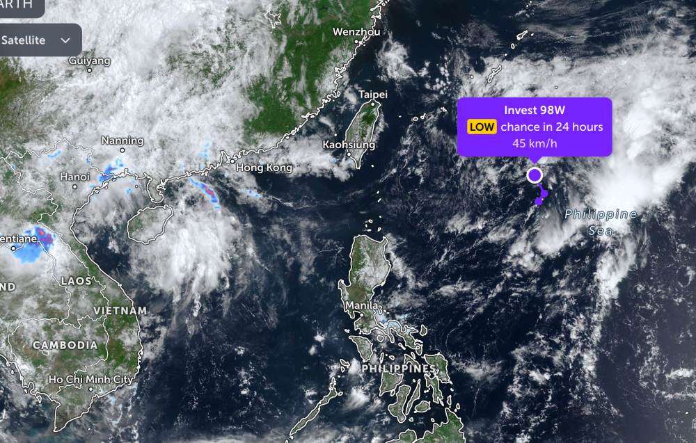
As of this morning, May 18, the location of the low pressure center with the symbol Invest 98W is currently in the Philippine waters. The strongest wind near the low pressure center reaches 45 km/h, gusting up to 50 km/h.
The low pressure is forecast to have little chance of strengthening into a tropical depression in the next 24 hours.
Because it is still quite far from the mainland, the low pressure only causes thunderstorms at sea, not significantly affecting the weather on the mainland around the area.
In the East Sea, on the morning of May 18, the Gulf of Tonkin area, the western sea area of the Northern East Sea (including the Hoang Sa special zone), and the sea area from Gia Lai to Lam Dong will have scattered showers and thunderstorms.
Forecast for the day and night of May 18, the Gulf of Tonkin area, the western sea area of the Northern East Sea (including the Hoang Sa special zone), the sea area from Gia Lai to Ca Mau, Ca Mau to An Giang and the Gulf of Thailand will have scattered showers and thunderstorms. In thunderstorms, there is a possibility of tornadoes, strong gusts of wind at level 6-7 and waves over 2.0m high.
All ships operating in the above areas are at risk of being affected by tornadoes, strong gusts of wind and high sea waves.
People and tourists planning to visit these sea areas should pay attention to weather forecasts. Follow local instructions and avoid going to sea when the sea is rough to ensure safety.


