According to storm news, the latest low pressure from the Joint Typhoon Warning Center (JTWC), two new low pressures have formed in the Indian Ocean.
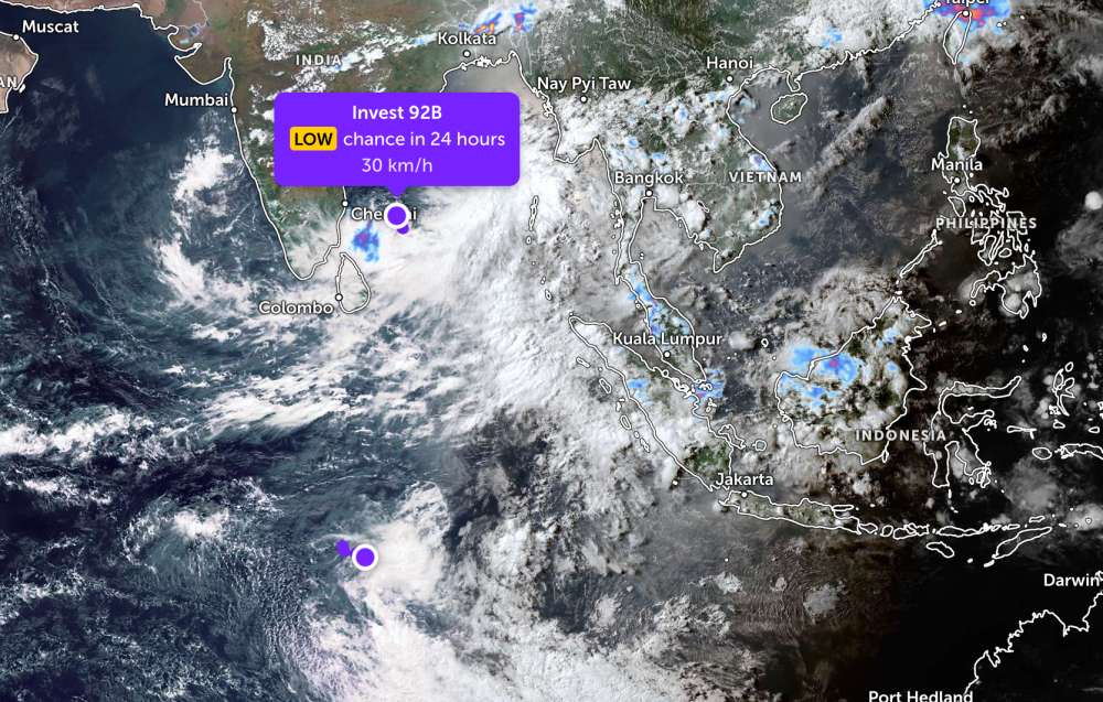
The first low pressure is coded Invest 92B, currently operating in the Bay of Bengal area. The strongest wind near the center of the low pressure reaches 30 km/h. JTWC forecasts that this low pressure is unlikely to strengthen into a tropical depression or storm in the next 24 hours.
Meanwhile, the second low pressure bearing the symbol nvest 94S is currently operating in the Southwest Indian Ocean. The strongest wind near the center of the low pressure reaches 45 km/h, gusting up to 50 km/h.
This system is also forecast to have a low probability of developing into a tropical depression or storm in the next 24 hours.
Because it is still quite far away, the two low pressures have not affected the adjacent mainland areas.
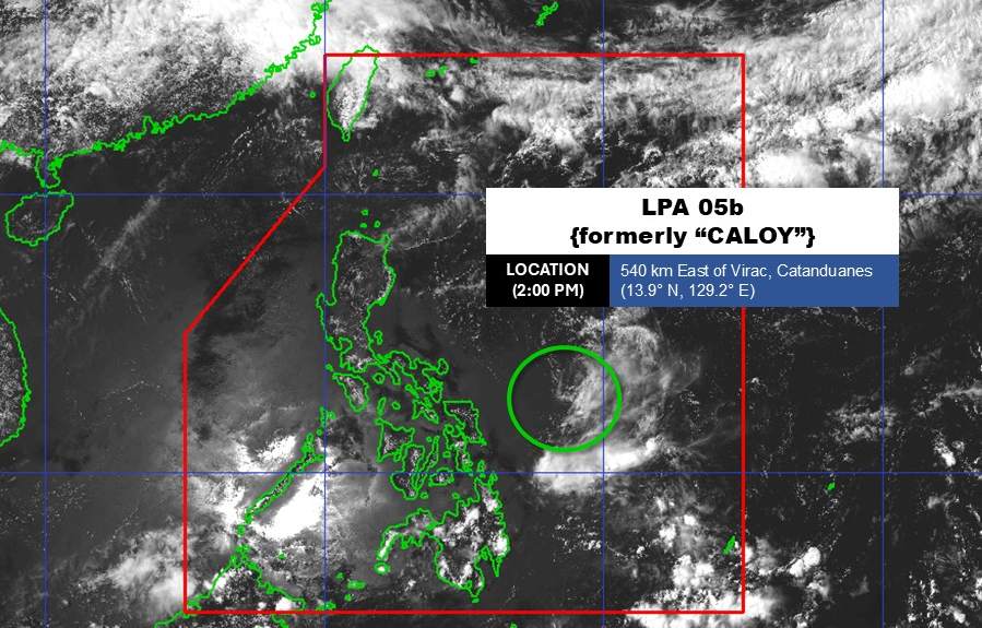
On the other hand, the weakening low pressure from Typhoon Hagupit is moving deeper into the Philippine Area of Responsibility (PAR).
As of 3 pm today (local time), the center of the low pressure was located at about 14.0 degrees North latitude - 129.3 degrees East longitude, located about 555 km east of Virac, Catanduanes province. The low pressure is unlikely to strengthen into a tropical depression, but is still being monitored to assess developments in the near future.
In the sea area of Vietnam, according to the National Center for Hydro-Meteorological Forecasting, on the night of May 13 and the day of May 14, the weather in most sea areas of the country is relatively stable, visibility is commonly over 10km, sea waves fluctuate from 0.5 - 2.5m.
The Northern Gulf of Tonkin area has south to southwest winds of level 4-5, highest waves of 2.5m, while the Southern Gulf of Tonkin and sea areas from Southern Quang Tri to Khanh Hoa are mainly rainless, the sea is relatively calm.
In the sea area from Lam Dong to Ca Mau, the South East Sea and Truong Sa special zone, there are showers and thunderstorms in some places. Especially in the area from Ca Mau to An Giang and the Gulf of Thailand, scattered showers appear, with thunderstorms in some places, with the risk of tornadoes and strong gusts of wind during thunderstorms.
People and tourists planning to visit these sea areas should pay attention to weather forecasts. Follow local instructions and avoid going to sea when the sea is rough to ensure safety against thunderstorms and big waves at sea.


