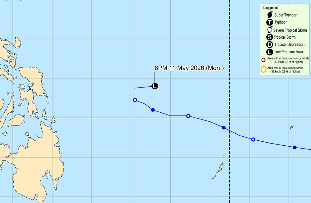
According to storm news, the latest low pressure from the Philippine Atmospheric, Geophysical and Astronomical Services Administration (PAGASA), a low pressure is operating in the Philippine area of responsibility.
The weakening low pressure from Typhoon Hagupit was positioned at 3 am this morning (local time) at 12.7 degrees North latitude - 131.1 degrees East longitude, 690 km east of Catarman, North Samar.
The strongest wind near the low pressure center reaches 30 km/h. The low pressure is unlikely to strengthen into a storm again in the next 24 hours.
PAGASA said that the low pressure suddenly reversed direction when approaching the mainland near the mainland area of the Philippines last night May 11 and early this morning May 12. It is forecast that this low pressure is unlikely to turn back and will not cause thunderstorms in any area on the mainland of the Philippines.
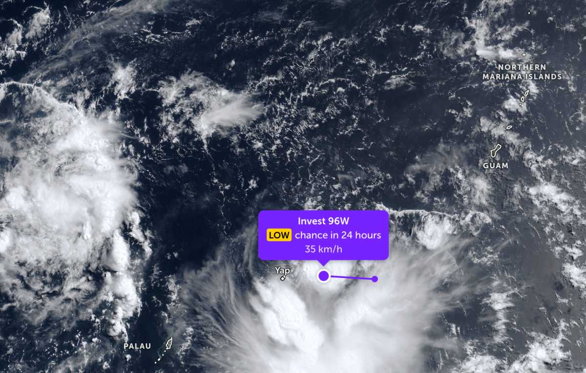
On the other hand, outside the Philippine area of responsibility, the low pressure bearing the symbol Invest 96W is strengthening at sea. The center of the low pressure is near Yap Island, Micronesia. The strongest wind near the center of the low pressure reaches 35 km/h. However, this low pressure is also forecast to have little chance of developing into a storm in the next 24 hours.
In the sea area of Vietnam, according to the National Center for Hydro-Meteorological Forecasting, the North and South of the Gulf of Tonkin have showers in some places, southeast to south wind level 3-4, sea waves 0.5 - 1.5m high.
The area from Quang Tri to Khanh Hoa is rainless, visibility over 10km, light wind, sea waves 0.5 - 1.5m high.
The sea area from Lam Dong to Ca Mau has showers and thunderstorms in some places. Meanwhile, the area from Ca Mau to An Giang and the Gulf of Thailand has scattered showers, with thunderstorms in some places. In thunderstorms, there is a possibility of tornadoes and strong gusts of wind. Visibility is over 10km, reduced to 4-10km in rain. Light wind, waves are 0.5 - 1.5m high; especially in the Gulf of Thailand, waves are 0.5 - 1.0m high.
In the Northern East Sea area, Hoang Sa special zone and the central East Sea region, the weather is generally rainless or with light rain in some places, visibility over 10km, light wind, sea waves 1.0 - 2.0m high.
The South East Sea area and Truong Sa special zone will have showers and thunderstorms in some places, northeast to easterly winds of level 3-4, visibility over 10km, sea waves 1.0 - 2.0m high.
People and tourists planning to visit these sea areas should pay attention to weather forecasts. Avoid going out to sea when the sea is rough and follow local instructions so that storms and big waves at sea do not cause danger.


