According to storm news, the latest low pressure from the Joint Typhoon Warning Center (JTWC), on the evening of May 9, Typhoon Hagupit had weakened into a tropical depression.
The center of the tropical depression is about 406 km west of Yap Island. In the past 6 hours, the tropical depression has moved westward at a speed of about 20 km/h.
The strongest wind near the center of the tropical depression reached 55 km/h, gusting up to 70 km/h. The highest wave height reached about 4.6 m.
JTWC forecasts that the tropical depression will continue to move in a West - Northwest direction with gradually weakening winds in the next 2 days.
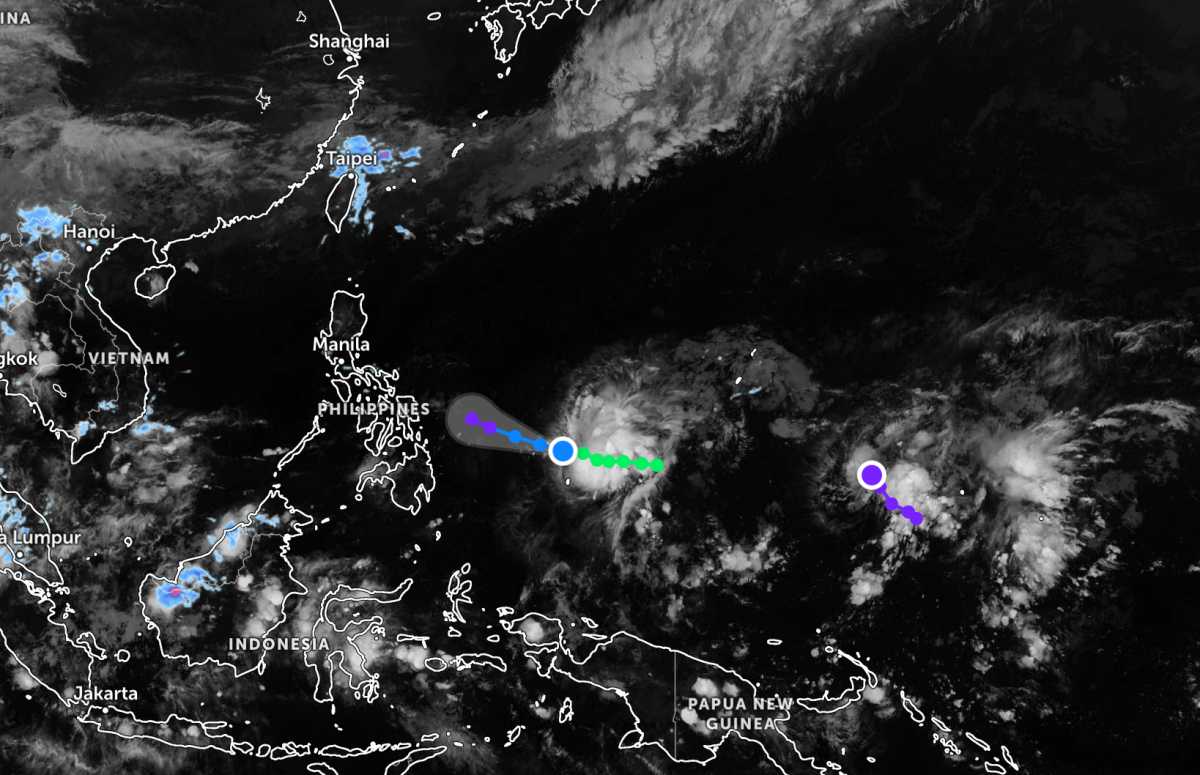
Not far away, the low pressure bearing the symbol Invest 95W is currently located in the Western Pacific region. The strongest wind near the center of the low pressure reaches 30 km/h. This low pressure is forecast to have a low probability of developing into a tropical cyclone in the next 24 hours.
In the East Sea, according to the National Center for Hydro-Meteorological Forecasting, on the night of May 9 and day of May 10, the Gulf of Tonkin area will have showers and thunderstorms in some places, visibility over 10km. Northeast to East wind level 3-4, sea waves from 0.5-2m high.
The sea area from South Quang Tri to Khanh Hoa has showers and thunderstorms in some places, visibility over 10km, light wind, sea waves 0.5-1.5m high.
The area from Lam Dong to Ca Mau, the South East Sea and Truong Sa Special Zone have showers and thunderstorms in some places, especially in some places there are scattered showers and thunderstorms, in thunderstorms there is a possibility of tornadoes and strong gusts of wind. Northeast to East wind level 3-4, sea waves 1-2m high.
The sea area from Ca Mau to An Giang and the Gulf of Thailand has scattered showers and thunderstorms in some places, it is necessary to be wary of tornadoes and strong gusts of wind in thunderstorms. Visibility over 10km, reduced to 4-10km in rain. Light wind, sea waves 0.5-1.5m high.
The North East Sea area has showers and thunderstorms in some places, visibility over 10km, northeast wind level 4-5, sea waves 2-3m high. Meanwhile, the area between the East Sea and the Hoang Sa Special Zone has Northeast wind level 3-4, sea waves 1-2m high.
People and tourists coming to these sea areas should pay attention to weather forecasts. Avoid going out to sea when the sea is rough and follow local instructions to avoid heavy rain and big waves at sea causing danger.


