According to new storm news from the Quang Dong Provincial Meteorological Station, the first landfall occurred at around 5:50 p.m. on July 20 in Hai Yen town, Giang Mon city, with maximum winds near the storm's center reaching 33m/s (equivalent to 118.8 km/h).
At about 20:15 on the same day, the storm continued to make a second landfall near Hai Linh Island in Duong Giang City, Quang Dong Province with gusts of up to 25m/s (equivalent to 90 km/h).
After that, Typhoon No. 3 Wipha is forecast to move west-southwest at a speed of about 20 km/h and continue to weaken.
Due to the complicated developments of the storm, the authorities of Quang Dong province had to urgently evacuate about 670,000 people in dangerous areas.
Heavy rain and strong gusts of wind due to the impact of Typhoon Wipha have paralyzed traffic in many key cities in the Chau Giang river region such as Quang Chau, Shenzhen, and Chu Hai. Airports in Shenzhen, Zhuhai and Hong Kong simultaneously canceled or delayed hundreds of flights.
The high-speed and inter-provincial railway lines connecting Guangzhou with Shenzhen and Zhuhai were also forced to stop operations. The Hoang Mao Hai sea overpass in Giang Mon is blocked, while the sea transport route through Quynh Chau Strait connecting Quang Dong with Hainan may continue to be interrupted until at least July 22.
In Hong Kong, at least 33 people were injured by the storm, 277 people had to take temporary shelter at 34 evacuation locations. The authorities recorded more than 700 cases of trees falling due to strong winds on July 20.
It is forecasted that on July 21, Hai Nam province will face a serious risk of flooding in the capital Hai Khau, while Quang Dong province will continue to suffer from thunderstorms, strong winds and big waves.
In the whole of Quang Dong province, at least 52 coastal tourist areas have temporarily stopped receiving visitors, many localities have issued orders to stop all production, construction, business activities and let students stay home from school until further notice.
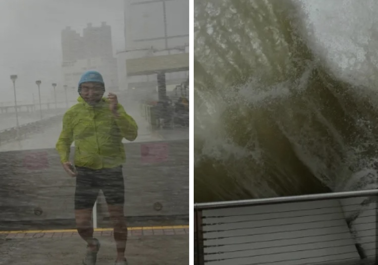
In some coastal areas, people said the strong winds caused some pedestrians to slide on the streets.
According to Global China, some localities are facing a high risk of landslides, flash floods and dike breaches in the coming days.
According to the Quang Dong Provincial Meteorological Station, heavy to very heavy rain will continue to fall on major cities in the Chau Giang River Delta and the western coast on July 21 and 22, along with the risk of local heavy rain.
The National Steering Committee for Flood and Storm Prevention and Control of China has raised the emergency response level for flood and storm prevention in the southern provinces of Guangdong and Hainan to level III - the second highest level in the system of four levels with level I being the most serious.
It is forecasted that on July 21, Typhoon Wipha will continue to cause heavy to very heavy rains in some areas of Hainan and Guangdong.
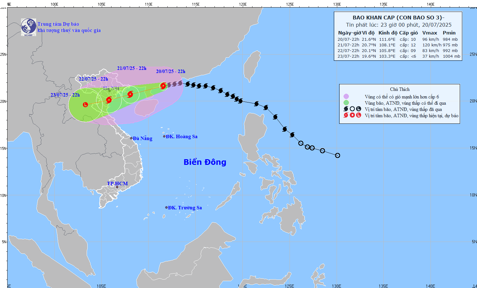
The National Center for Hydro-Meteorological Forecasting said that in the next 24 hours, storm No. 3 Wipha will move into the Gulf of Tonkin, directly affecting the weather in the coastal provinces of Northern and North Central Vietnam.
Tourists planning to visit Quang Ninh, Hai Phong, Nam Dinh, Thanh Hoa and the Central Coast region should closely monitor weather developments, proactively adjust their itinerary, and avoid going to sea during times of high waves, strong winds, and complex thunderstorms. Outdoor sightseeing and tourism activities should also be postponed or replaced with indoor experiences to ensure safety.