According to storm news, the latest low pressure from the Joint Typhoon Warning Center (JTWC), a low pressure is strengthening near the East Sea.
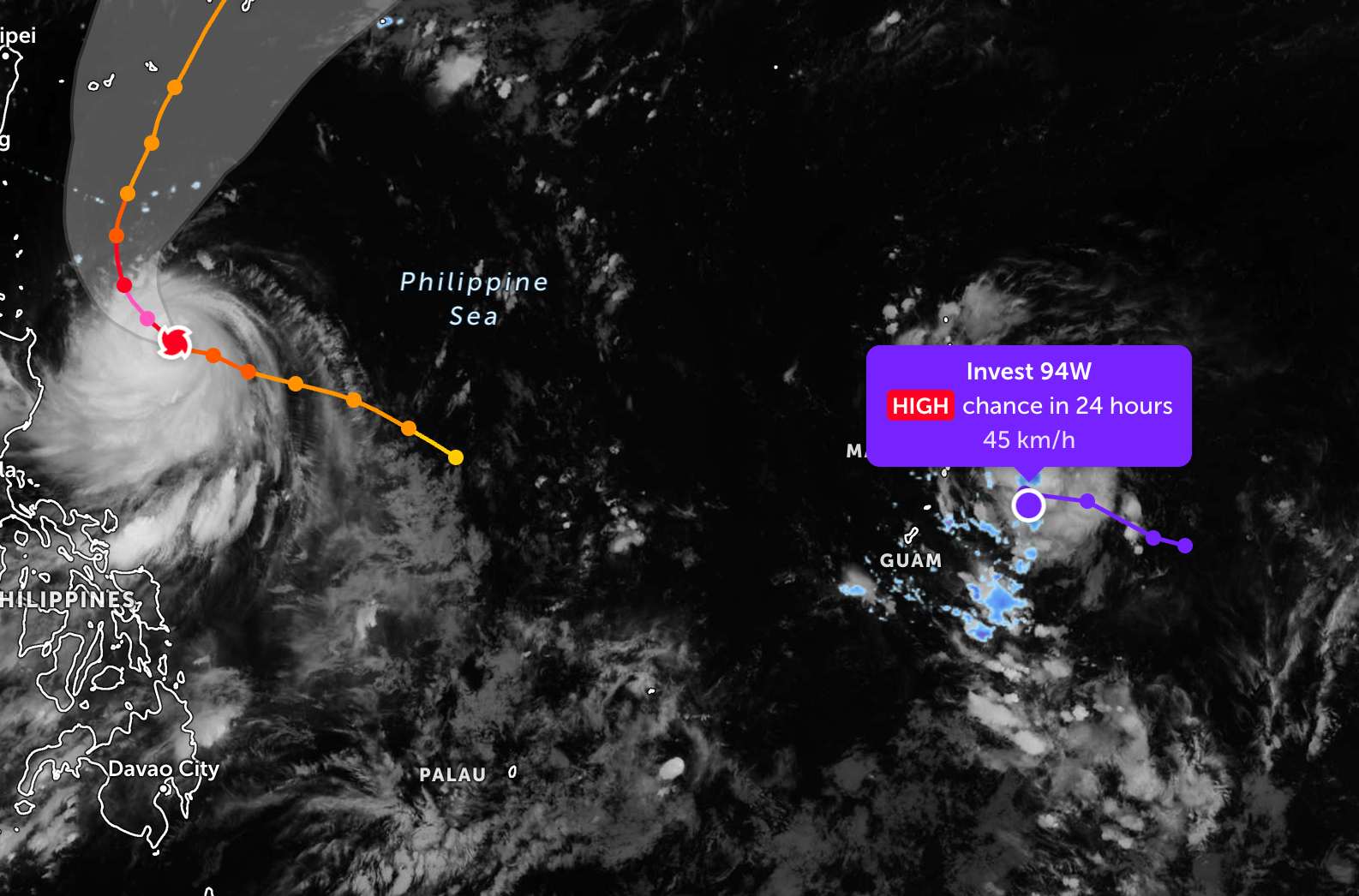
As of the evening of June 22, the low pressure bearing the symbol Invest 94W is operating near the Northern Mariana Islands area. The strongest wind near the center of the low pressure reaches 45 km/h.
JTWC forecasts that the low pressure is highly likely to develop into a tropical depression or storm in the next 24 hours.
In the past 6 hours, the low pressure has moved westward, towards the East Sea and then suddenly turned southward, moving slowly on a new trajectory.
Because it is still quite far from the mainland, the low pressure only causes thunderstorms at sea, not affecting much the adjacent mainland areas.
In the East Sea, according to the National Center for Hydro-Meteorological Forecasting, in the afternoon and evening of June 22, the South East Sea area (including Truong Sa special zone) will have showers and thunderstorms.
Forecast for the night of June 22 and day of June 23, the sea area from Lam Dong to Ca Mau, Ca Mau to An Giang, the Gulf of Thailand and the South East Sea area (including Truong Sa special zone) will have showers and thunderstorms.In thunderstorms, there is a possibility of tornadoes, strong gusts of wind at level 6-7, sea waves over 2.0m high.
All ships operating in the above areas are at risk of being affected by tornadoes, strong gusts of wind and high sea waves.
People and tourists planning to visit these sea areas should pay attention to weather forecasts. Follow local instructions to avoid thunderstorms at sea that are dangerous throughout the journey.


