According to storm news, the latest low pressure from the Joint Typhoon Warning Center (JTWC), three low pressures are operating in the Pacific Ocean.
In which, the new low pressure area is operating in the eastern Pacific region. This low pressure has a 10% chance of developing into a tropical depression or tropical storm in the next 2 days, and a 10% chance of developing in the next 7 days.
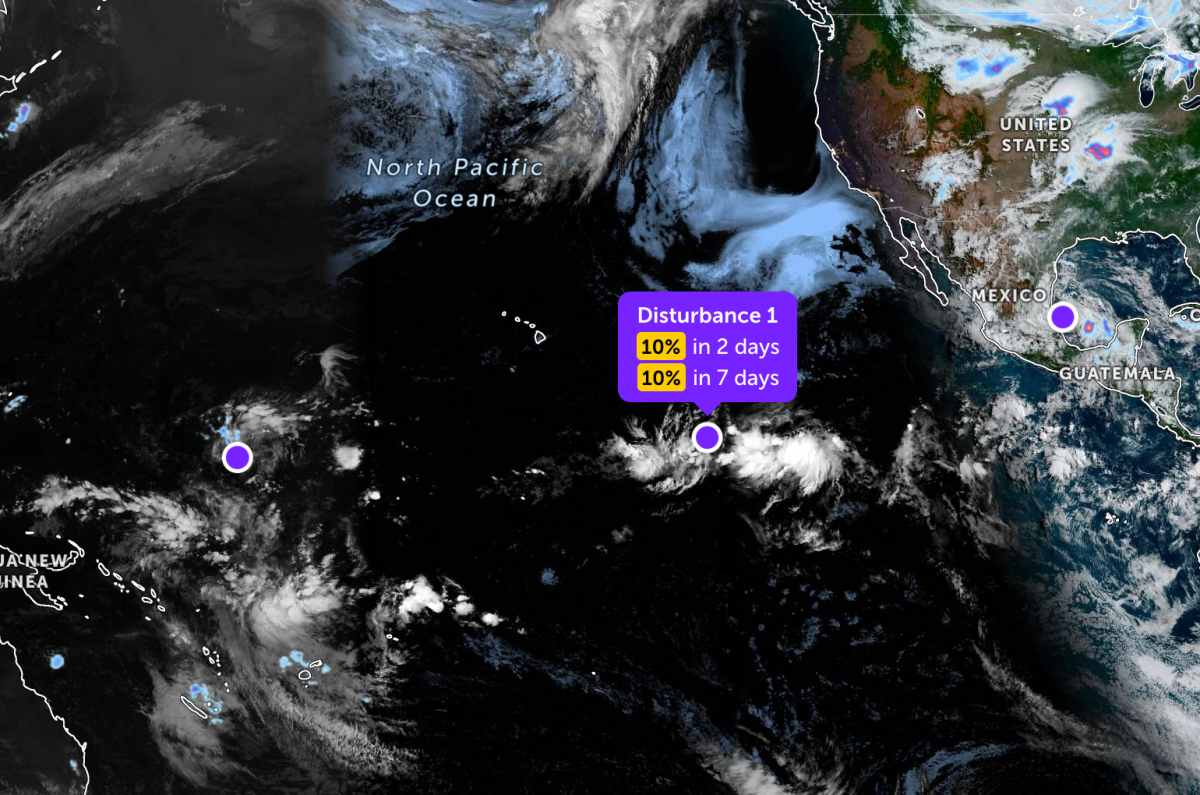
In the southwest of the Baja California peninsula, a low pressure trough, related to the remnants of Hurricane Amanda, is causing scattered showers and thunderstorms.
It is predicted that this system is unlikely to strengthen significantly, when moving in the East to Northeast direction at a speed of about 8-16 km/h in the next few days.
Meanwhile, the low pressure bearing the symbol Invest 92W is currently located in the Western Pacific region. The strongest wind near the center of the low pressure reaches 30 km/h.
The low pressure moves in a West - Northwest direction. This system is unlikely to develop into a tropical depression in the next 24 hours.
In addition, another low pressure area is currently in the area near central Mexico. This low pressure area has a 20% chance of developing into a tropical depression or tropical storm in the next 2 days, and a 20% chance of developing in the next 7 days.
It is forecast that this low pressure area may return to the Northwest Gulf of Mexico sea area next Tuesday or Wednesday. However, conditions in that area are also only near a favorable threshold for development, so the possibility of strengthening is still limited.
People and tourists planning to go to Baja or Central Mexico should pay attention to the weather. Do not go out to sea when the sea is rough to avoid thunderstorms and big waves at sea that are dangerous throughout the journey.


