According to the latest storm news from the Joint Typhoon Warning Center (JTWC), two new low pressures from off the Indian Ocean have made landfall in Australia.
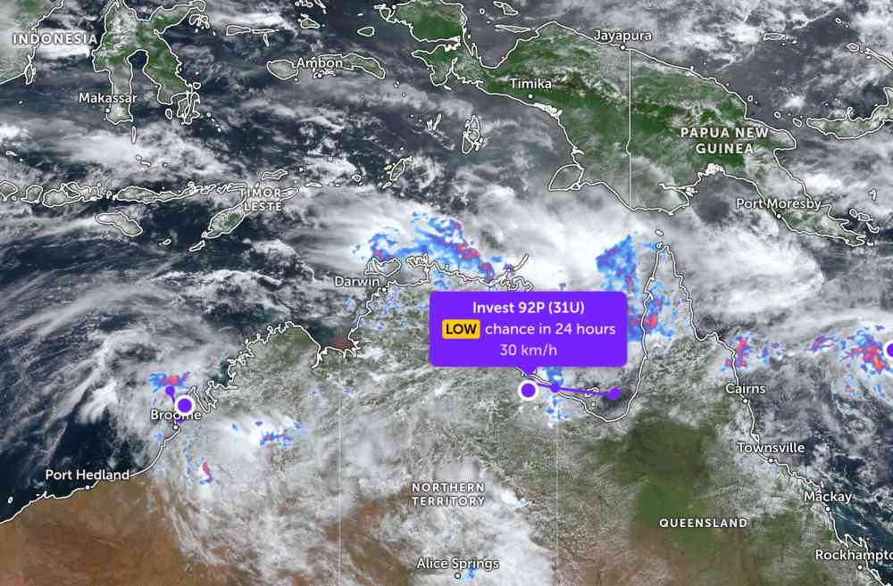
The low pressure bearing the symbol Invest 92P (31U) is currently located in Northern Australia. The strongest wind near the low pressure center reaches 25-30 km/h. The low pressure is unlikely to strengthen into a storm in the next 24 hours.
Meanwhile, the low pressure bearing the symbol Invest 93S (30U) is located in western Australia. The strongest wind near the center of the low pressure reaches 35 km/h. The low pressure is also forecast to have little chance of developing into a tropical storm in the next 24 hours.
Low pressure areas are forming in the monsoon trough in northern Australia, which is likely to bring rain, storms and heavy rainfall to the northernmost part of Queensland and the northern tropical coast, even spreading to the Gulf of this country.
The Australian Meteorological Administration said that it is currently the period of strong monsoon activity in Northern Australia, and there will be heavy rain. Showers are spreading across the country's north, especially the northeastern areas of Queensland.
On the night of March 2nd, the tropical coastal area in northeastern Queensland experienced rainfall from 100mm to 300mm, causing a major flood warning for the Herbert River. In addition, there is also a small flood warning on the Daintree River.
Tourists planning to travel to Northern and Western Australia during this time should pay attention to weather forecasts. Check flight schedules, update information from transportation units and follow local instructions to ensure safety.


