According to storm news, the latest low pressure from the Joint Typhoon Warning Center (JTWC), a new low pressure formed near the East Sea.
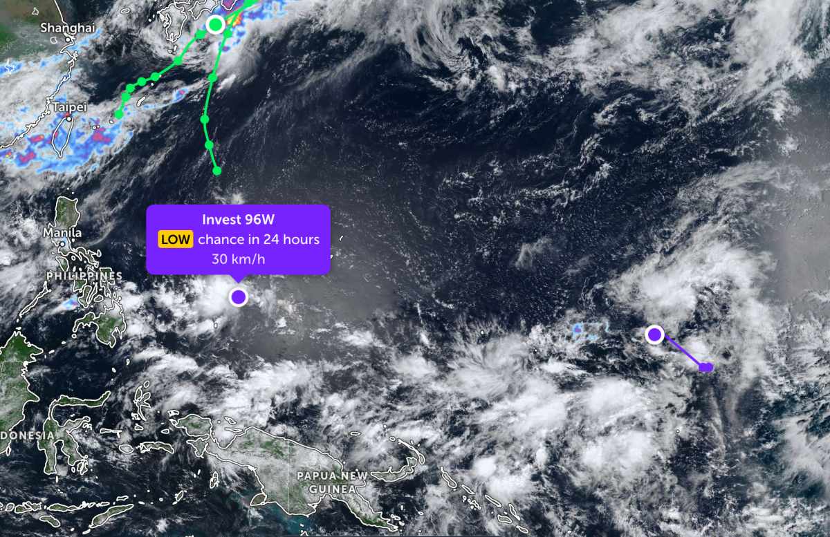
As of the morning of June 27, the location of the low pressure center with the symbol Invest 96W is currently in the area near Yap, Micronesia.
The strongest wind near the low pressure center reaches 30 km/h. The low pressure is unlikely to strengthen into a storm in the next 24 hours.
While not far away, the low pressure bearing the symbol Invest 95W is currently operating in the Western Pacific region. The strongest wind near the center of the low pressure has strengthened to 35 km/h. However, this low pressure is also forecast to have little chance of strengthening into a tropical depression or storm in the next 24 hours.
On the other hand, Typhoon Higos and Typhoon Mekkhala have both gradually weakened and moved away from the East Sea, entering the Japanese sea area.
In the East Sea, according to the National Center for Hydro-Meteorological Forecasting, the area between the East Sea and the Gulf of Thailand is experiencing scattered showers and thunderstorms. In Phu Quy special zone, strong southwest winds of level 5, sometimes level 6, and rough seas have been recorded.
Forecast for the day and night of June 27, the sea area from Khanh Hoa to Vinh Long and the sea area west of the South East Sea (including the sea area west of Truong Sa special zone) will have strong southwest winds of level 5, sometimes level 6, gusts of level 7-8, rough seas; by night the wind will gradually decrease. Sea waves are 2.0-3.0 m high.
Meanwhile, the sea area of the Northern Gulf of Tonkin, the sea area from Ca Mau to An Giang, the Gulf of Thailand and the Central East Sea area have scattered showers and thunderstorms. In thunderstorms, there is a possibility of tornadoes, strong gusts of wind at level 7-8, sea waves over 2.0 m high.
The meteorological agency warns that all ships operating in the above-mentioned sea areas are at high risk of being affected by strong winds, tornadoes and large waves. Disaster risk level due to strong winds at sea is level 2.
People and tourists planning to visit these sea areas should pay attention to weather forecasts. Avoid going out to sea when the sea is rough and follow local instructions to ensure safety.


