According to storm news, the latest low pressure from the Joint Typhoon Warning Center (JTWC), a low pressure currently operating near the Yucatán peninsula, an area between the Caribbean Sea and the Gulf of Mexico. This low pressure has a 10% chance of developing into a tropical depression in the next 48 hours and maintaining a 10% level in the next 7 days.
Experts predict a widespread low pressure area may form over Campeche Bay on June 12, related to tropical waves moving west through the Yucatán Peninsula region of Mexico. Environmental conditions are assessed to be only near-favorable for further development of this low pressure area in the coming days.
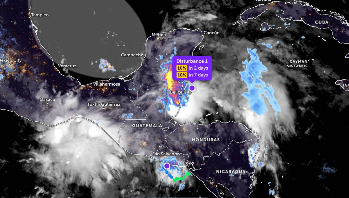
While not far away, storm Cristina has weakened into a low pressure area.
The remnants of Hurricane Cristina are causing heavy rain in coastal areas of Central America on June 11. Heavy rain can cause flash floods and dangerous landslides, especially in steep mountainous areas.
According to satellite data, the remnants of storm Cristina have completely lost its closed circulation structure and weakened into a weak low pressure trough near the coast of El Salvador. This remnant area is expected to move northwest through El Salvador and Guatemala on June 11, continuing to cause heavy rain, increasing the risk of flooding and landslides in high-lying areas.
In the East Sea, according to the National Center for Hydro-Meteorological Forecasting, in the afternoon of June 11, the North and South of the East Sea, the sea area from Lam Dong to Ca Mau, from Ca Mau to An Giang will have scattered showers and thunderstorms.
Forecast for the night of June 11 and day of June 12, the sea area from Lam Dong to Ca Mau, Ca Mau to An Giang, the Gulf of Thailand, the northern sea area of the North East Sea and South East Sea (including Truong Sa special zone) will have scattered showers and thunderstorms. In thunderstorms, there is a possibility of tornadoes, strong gusts of wind at level 7-8, sea waves over 2.0m high.
All ships operating in the above areas are at risk of being affected by tornadoes, strong gusts of wind and high sea waves. People and tourists planning to visit these areas should regularly monitor weather forecasts and follow local instructions to avoid dangerous storms at sea.


