According to storm news, the latest low pressure from the Joint Typhoon Warning Center (JTWC), the tropical depression in the Pacific Ocean has officially strengthened into a storm.
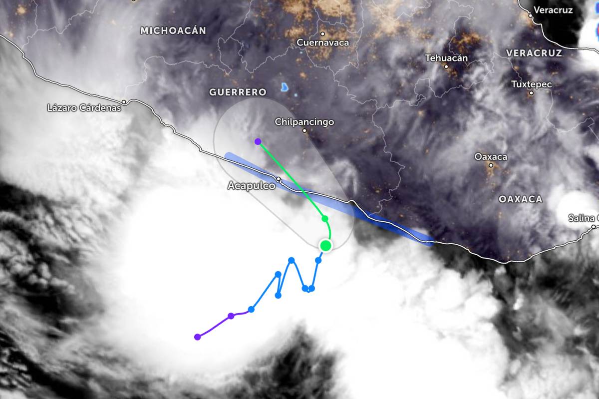
The tropical storm is called Boris. The strongest wind near the center of storm Boris reaches about 65 km/h. The storm moves in a northeast direction at a speed of about 7 km/h and approaches the southern coast of Mexico.
On June 8, Hurricane Boris will turn north, then gradually shift to the Northwest before making landfall in Mexico's Guerrero state in the afternoon or evening of the same day. The forecast trajectory shows that the eye of the storm will quickly go deep inland and weaken due to the impact of high mountain terrain.
JTWC assessed that Hurricane Boris may strengthen slightly before making landfall. However, the storm's circulation is still quite wide and prolonged, while the southeast windbreak at the upper atmosphere is active, limiting the possibility of a significant intensification of the storm.
After entering the mainland, the high mountainous terrain of Mexico is forecast to rapidly weaken the low-level circulation. Storm Boris is likely to dissipate completely in the next 36 hours.
Although the intensity is not too strong, the biggest risk from Hurricane Boris is very heavy rainfall pouring down on southern Mexico. The US meteorological agency warns that widespread heavy rain could cause severe flooding, flash floods and landslides in many areas, especially in steep terrain.
In addition, tropical storm weather conditions are expected to affect the southern coastal region of Mexico located in the storm warning area on June 8.
Authorities recommend that people in southern Mexican states closely monitor the developments of Hurricane Boris, and take proactive measures to prevent flash floods and landslides. Tourists should check their flight schedules regularly and limit travel through high-risk areas when heavy rain occurs.


