According to storm news, the latest low pressure from the Joint Typhoon Warning Center (JTWC), a new low pressure has formed in the Indian Ocean.
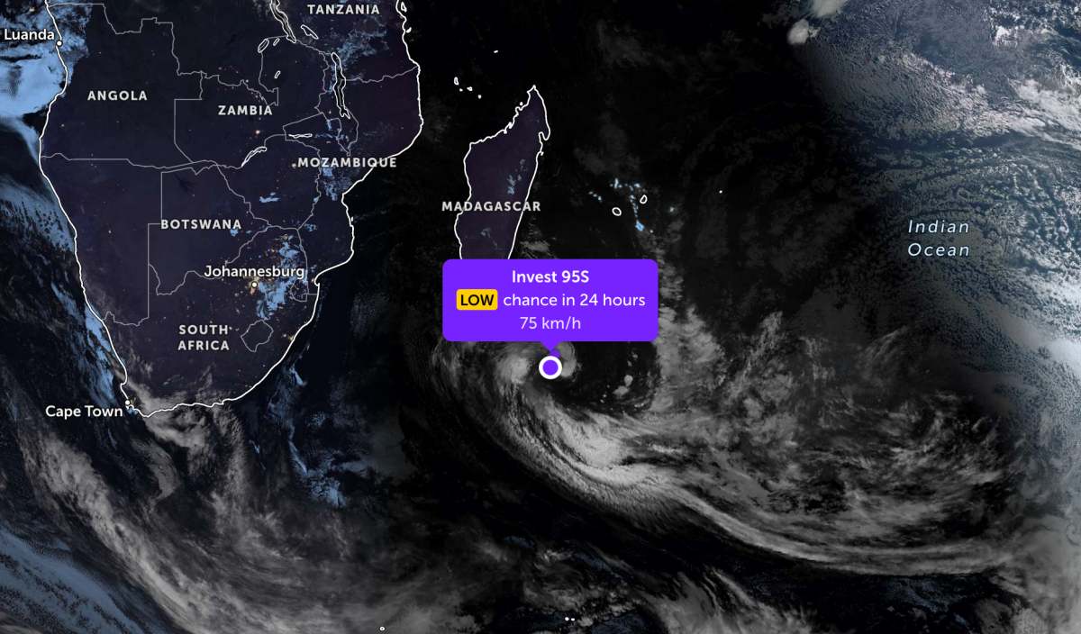
As of this morning, June 11, the center of the low pressure is over the southwest sea of the Indian Ocean. The strongest wind near the center of the low pressure reaches 75 km/h, gusting up to 80 km/h.
The low pressure is forecast to have little chance of developing into a tropical depression or storm in the next 24 hours.
Because it is still far from the mainland, the low pressure only causes thunderstorms at sea, not affecting much the adjacent mainland areas.
In the East Sea, according to the National Center for Hydro-Meteorological Forecasting, on the morning of June 11, the North and Central East Sea areas (including Hoang Sa special zone), the Southern Gulf of Tonkin area, the sea area from Ca Mau to An Giang and the Gulf of Thailand will have scattered showers and thunderstorms.
Forecast for day and night of June 11, the Southern Gulf of Tonkin area, the sea area from South Quang Tri to Quang Ngai, from Lam Dong to Ca Mau, from Ca Mau to An Giang, the Gulf of Thailand, the North and Central East Sea areas (including Hoang Sa special zone) will have scattered showers and thunderstorms.In thunderstorms, there is a possibility of tornadoes, strong gusts of wind at level 7-8.
All ships operating in the above sea areas are at risk of being affected by tornadoes, strong gusts of wind and high waves.
People and tourists planning to visit these sea areas should pay attention to weather forecasts. Follow local instructions to avoid storms and big waves at sea that are dangerous.


