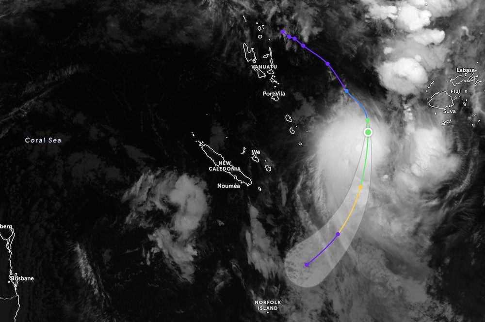
According to the latest low pressure news from the Joint Typhoon Warning Center (JTWC), the tropical depression has intensified into a tropical storm 18P. The Tropical Storm Center in Fiji has named this system TD07F.
The storm is currently located about 504 km west of Suva (Fiji) and has moved southeast at a speed of about 37 km/h.
The strongest wind in the area near the storm center has reached 75 km/h.
The highest wave height is up to about 5.5 m, the sea is rough.
Forecast for the next 24 hours, the storm will reach maximum intensity, wind speeds up to 95 km/h.
This is the first storm in the 2025-2026 storm season in Vanuatu.
Tropical Storm 18P is forecast to continue to follow the eastern edge of the subtropical high pressure axis.
In the next 12 hours, the storm will move in a South-Southeast direction, then gradually shift to the South-Southwest direction.
It is expected that the storm will weaken and completely dissipate at sea in the next 36 hours, as the subtropical high pressure gradually shifts westward.
Tourists planning to travel to Vanuatu or areas near the South Pacific need to closely monitor weather bulletins and tropical storm warnings in the coming days.
Sea waves over 5 m high can cause serious danger to ships, marine tourism activities, diving and waterway transport.
Fishermen and tourists should limit going out to sea, comply with the guidance of local authorities and meteorological agencies, and proactively adjust their schedules to ensure safety during storms or tropical depressions that still affect the area.
It is forecast that the southwestern Pacific region may record up to 9 tropical storms in the official storm season, lasting from November last year to April this year.
Meanwhile, the National Center for Hydro-Meteorological Forecasting recorded that the sea area northeast of the Northern East Sea and Huyen Tran station have strong Northeast winds of level 6.
Forecast for the night of January 28 and day of January 29, the sea area northeast of the Northern East Sea area: Northeast wind level 6, gusts level 7-8; rough seas; waves 2.0-4.0m high.
Sea area from Lam Dong to Vinh Long: Northeast wind level 5, sometimes level 6, gusts level 7; rough seas; waves 2.0-3.0m high.
The sea area west of the South East Sea area (including the western part of the Truong Sa special zone): at night there will be Northeast wind level 6, gusts level 7; rough seas; waves 2.0-3.0m high; from tomorrow the wind will gradually decrease.
All ships operating in the above areas are at high risk of being affected by strong winds and big waves.


